Pete's Walks - The Chiltern Chain Walk, Walk 15
If you are considering walking this route yourself, please see my disclaimer. You may also like to see these notes about the maps and GPX files.
Google map of the walkDownload GPX file of the walk
Walk 15 4/06/08 – Hambleden and Ibstone (12.9 miles approximately)
Parked in village car park in Hambleden.
If you are interested in walking this route yourself, click here to see the route description (but only if you have already read my disclaimer and notes regarding route descriptions).
This morning I had one of those annoying drives when I seemed to forever get stuck behind slow-moving vehicles. The journey took 5-10 minutes longer than it would normally, and so, despite an early start from Kensworth, it was 10.10am when I started walking from the car park in Hambleden.
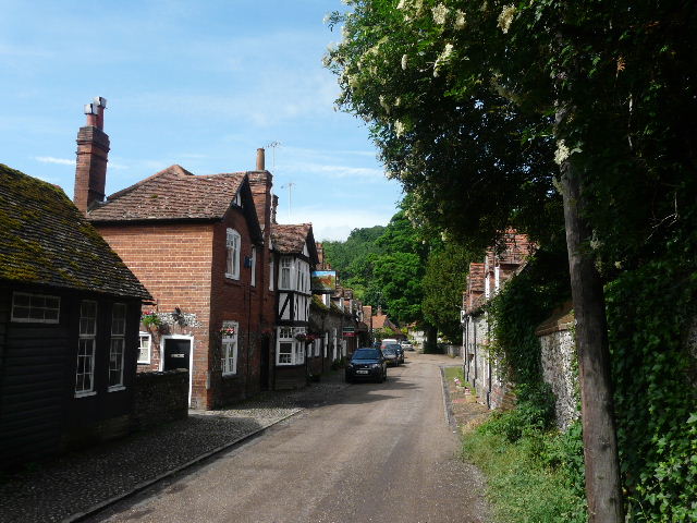
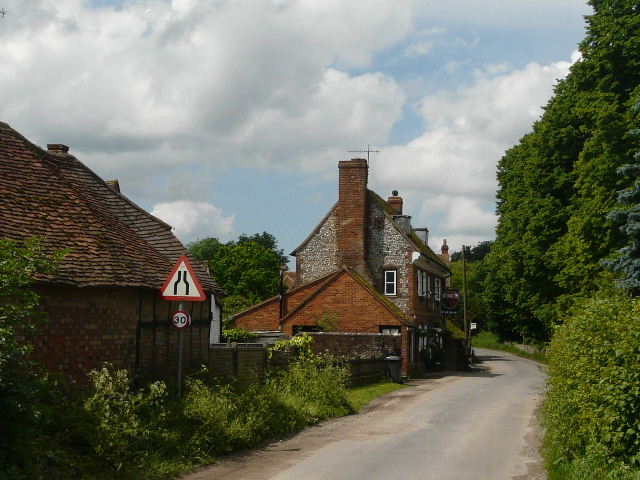
[1]Hambleden
Hambleden, set in its valley rimmed by woods, has remained an unspoilt village due to the benevolence of the Hambleden estate that owns much of it, and the National Trust to which most of it is covenanted. It has therefore avoided the ravages of modern development. Its characteristic Chiltern brick-and-flint houses have made it an ideal setting for films and TV. There is an old pump by a tree in the village square, and several old-fashioned shops. In the Domesday Book of 1086 it is recorded that the manor of Hambleden was given to Queen Matilda. A mill at Mill End a mile south of the village then paid an annual rent of £1, and there is still a mill on that site today (the weir is said to have been built in the reign of Henry V, 1413-1422). In 1215 the manor was held by King John, through his subsidiary title as Earl of Gloucester. It then passed to Richard de Clare and then his son Gilbert de Clare – these two were the next two signatories of the Magna Carta after King John himself. 1215 is also the first year that mention is made of a Rector of Hambleden, Ralph Neville. He was a prominent statesman, holding five other livings and holding the very important role of Chancellor of England. He became Bishop of Chichester in 1224 and seven years later was appointed Archbishop of Canterbury – however the Pope refused to ratify this latter appointment. St Thomas de Cantilupe, the last pre-Reformation English saint, was born in Hambleden. He too was a Chancellor of England (1265) and became Bishop of Hereford in 1275. He died in 1282, being canonised in 1320.
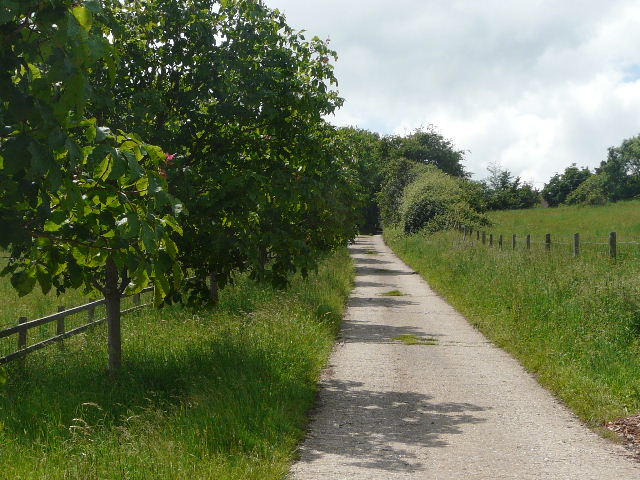
I turned left out of the car park, and wandered down the street [1] into the centre of the village. The workshop and family butcher’s on the left were familiar from numerous TV series. I crossed the triangular ‘square’ in the centre of the village (as usual pretty full with parked cars), with the church to my right [2]. I followed the narrow street ahead of me, passing more quaint brick and flint cottages. It soon turned right, with the Hamble Brook flowing to my left. The road was partly flooded as I went by the church again.
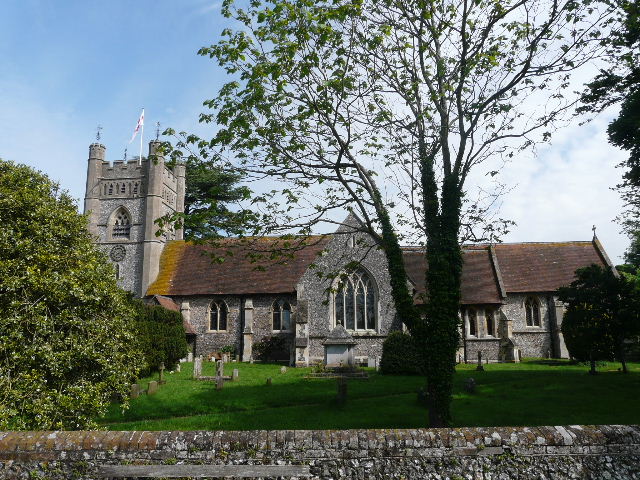
[2] Hambleden Church
Hambleden church is originally Norman, but built on the site of an earlier Saxon church. It has been much changed over the centuries. There is an ancient font that may be early 12th century or even a relic of the Saxon church – it is certainly where the previously mentioned St Thomas de Cantilupe was baptised. In the North Transept is a monument to Sir Cope D’Oyley, his wife and ten children, consisting of alabaster figures in front of a plaque. A few of the figures of the children carry skulls, a sign that they predeceased their parents. In the graveyard is the tomb of W. H. Smith – for many years a church warden here, he was the founder of the stationers that bears his name, an MP and a statesmen, and later the first Viscount Hambleden. His descendants still live in the village.
I soon came to a kissing-gate on the right, where I followed a path across a large flat pasture. There were a large number of young bullocks here and they were congregated by the kissing gate on the far side, so I had to march right through them, ushering a few of them out of my way so I could reach the gate. The path continued through a smaller empty pasture (possibly interconnected with the first one, as when I drove home I saw the bullocks were now in both pastures). The path then ran alongside a wooden fence beside a meadow to reach the hamlet of Pheasant’s Hill [3]. When I first came here on the Chiltern Way in 2005, there was a topiary face (like one of the Mr Men) carved in the corner of a hedge here. It has long gone, but I could just about see the gash where its mouth had been.
[3]The path to Pheasant's Hill
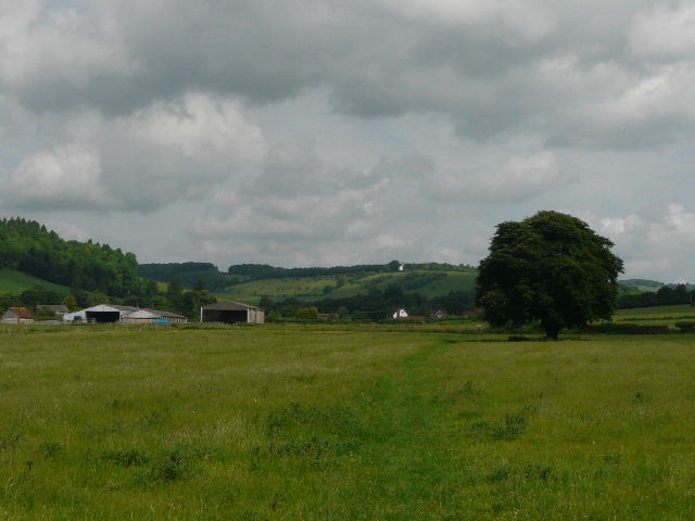
The path continued as an alley between hedges and fences, the alley dividing a series of gardens in two. I crossed a lane and left the hamlet, following the right-hand hedge of another pasture – there were more cattle here, but some distance away to my left. I saw some Buzzards circling over the wood on top of the hillside to my right. The path soon switched to the right of the hedgerow, as it continued through a corn field. It then went through a paddock, where two horses had some masks made of netting, to protect there eyes from flies. I now reached the hamlet of Colstrope, where I followed the lane ahead of me past a few houses. After a hundred yards or so the lane turned right, but I carried on ahead along the footpath.
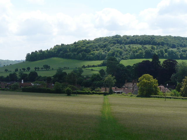
[4] The hillside to the west of the Hambleden Valley, near Colstrope
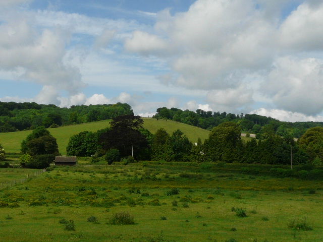
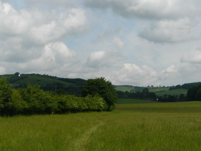
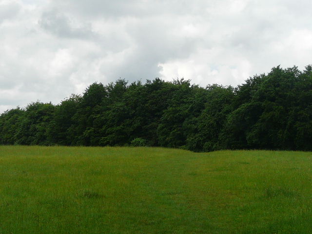
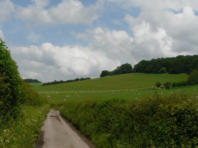
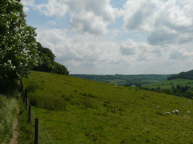
This early part of the walk was all along the Hambleden Valley (and was following the Chiltern Way as far as Fingest). The valley is quite broad and flat bottomed, with the Hamble Brook flowing through it. Either side are steepish hillsides [4], in most places topped by woods. This is popular country for Red Kites (I’d seen a few already) as well as the Buzzards I’ve already mentioned. Looking ahead (north) along the valley, I could see a windmill, Cobstone Mill, on top of its hill above Turville and Fingest, two of the villages I’d be passing through today.
In my opinion, the Hambleden valley is one of the best areas for seeing Red Kites in the Chilterns. These magnificent reddish-brown and grey birds, with their five-foot wingspan and distinctive forked tail, became extinct in England and Scotland at the end of the 19th century, due to persecution and egg-collecting. Only a few pairs remained in remote mid-Wales. In 1989 a project was launched to re-introduce Red Kites in the Chilterns and elsewhere. Over the next five years around 90 birds from Spain were released in the Chilterns, and the first successful breeding took place in 1992. There are now thought to be over 300 pairs of Red Kites in the Chilterns – the reintroduction here has been so successful, that between 2004 and 2006 94 birds were taken from here to start a new population in the North East of England. Don’t assume all large birds of prey you see here are Red Kites, though, as Buzzards are also doing well in the Chilterns as elsewhere in the country. At a distance they are most easily distinguished from Red Kites by their fan-shaped tail – they also have slightly shorter and broader wings. It is not uncommon to see both birds together.
[5]The path approaching Arizona Farm
The path continued alongside a hedge on my left, through another arable field, and then ran through a short section between hedges, with many tree roots exposed across the path. I crossed another lane, and continued on a path through a meadow. Here I photographed what turned out to be a Burnet Companion moth - as usual I got it identified ona website. I continued across a large empty pasture, with the large buildings of Arizona Farm ahead [5] and slightly to my left (California is a fairly popular place name, but this is the only Arizona I’ve come across on my walks). Soon I was again following the left-hand hedge of another arable field, where I managed to photograph a Yellowhammer on a wire along here. I then crossed a large empty paddock. I passed a man coming the other way with two dogs – I said ‘Good Morning!’ but he completely ignored me. Strange – still, if he wants to be a rude ignorant fellow that’s his problem, not mine. I wouldn’t dream of saying hello to a stranger in a town or city, but when passing someone in the countryside it is usual to greet them politely. Anyway, I now reached a lane on the edge of Skirmett, where I turned right [6].
[6]The path approaching Skirmett
Like nearby Fingest, Skirmett has always been a hamlet within the parish of Hambleden. Unusually for this part of the country, its name is of Norse origin, meaning ‘Shire meeting place’. The popular village pub is called The Frog. It was originally the King’s Head but after it went through a spell when it had a bad reputation (for some reason) it was decided to rechristen it, to mark a break with the past. Apparently the new name was chosen because Skirmett rhymes with Kermit!
[7]The large meadow near Skirmett
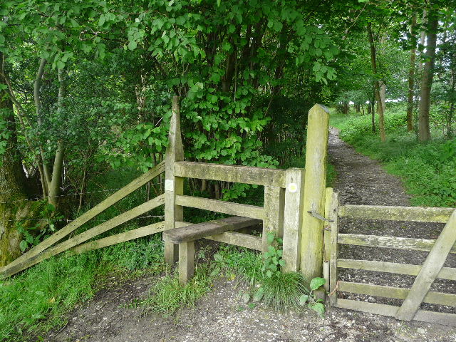
A short distance down the lane, I turned onto a path going left. I followed the field edge on my left, in a very large meadow [7], with the houses of Skirmett a short distance further left. The path followed the left edge of the meadow, then turned right along the wooden fence on the far edge – due to the rather irregular shape of the meadow, it was effectively going around two sides of a triangle. At one point I saw footprints through the grass taking a short-cut direct to the far corner, but I resisted the temptation to follow them. When I did get to the far corner, I found the wooden gate there had been paid for by Cherry Red records – I have come across numerous new stiles and gates while I’ve been walking the Chiltern Chain Walk, often with signs indicating they were provided by walker groups, or by local residents, or individuals, or in memory of someone, but I think this is the first one I think I’ve come across that’s been paid for by a company.
[8]The track to Adam's Wood
I crossed a corner of another meadow. Close to a corner of a lane I turned up a hedge-lined chalky track heading quite steeply uphill towards a wood [8]. I noticed some Woody Nightshade growing here, as I trudged slowly along – it was now very warm and I was glad to reach the cooling shade of the trees of Adam’s Wood, which is another wood managed by the Woodland Trust (this external link opens in a new window). The chalky path continued uphill through the wood, the gradient easing after a short while. It was very pleasant following the path through the trees, now rising very slowly and easily. On the far side of the wood I reached a track, where I went a few yards to the left to a gateway. The path, still following the route of the Chiltern Way, now crossed a hilltop meadow with woods on three sides, the fourth side dipping out of view into the valley below. On the far side of the meadow [9], the path ran for a hundred yards or so through Fingest Wood.
[9]Path across the meadow, heading to Fingest Wood
[10] Fieldfare's stile
I left the wood by going over Fieldfare’s Stile [10], named in honour of a renowned nature writer, who understandably loved this spot. One of the posts supporting the stile had the grid reference carved into it. This is a terrific viewpoint, looking down over the village of Fingest [11] which lies close to where five valleys meet (including the Hambleden valley) - on the hilltop behind Fingest stands the white Cobstone Mill [12].
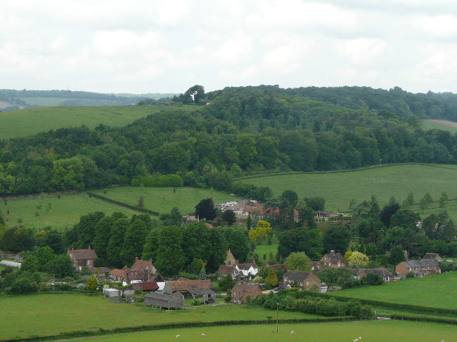
[11] Fingest from Fieldfare's stile
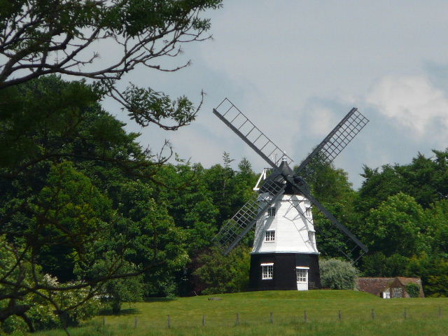
[12] Cobstone Mill
Cobstone Mill stands on top of a hillside between Turville and Fingest. It overlooks a point where four smaller valleys meet and the Hambleden Valley starts southwards to the Thames. The white-painted, eighteenth-century smock mill is thus visible for some distance in several directions. Like the village of Turville below it, it is a popular setting for films and TV, and is probably best known as the windmill in the film ‘Chitty Chitty Bang Bang’.
[13] Fingest
I turned left, following the edge of the wood as it curved right and down the slope. The huge pasture I was in was empty today, but there are sometimes sheep here. I continued along a hedgerow through a field in the bottom of the valley, reaching a lane on the far side where I turned left to enter Fingest [13]. I turned right opposite the Chequers pub, finally leaving the Chiltern Way but briefly retracing part of my previous walk. The church with its massive Norman church was now on my left. Walk 14 had used a path that came in on my right, but I continued on down the lane as it left the village. The lane was narrow and hedge-lined [14], but fortunately very quiet and only one vehicle passed me here. Beyond the hedge on the right were large sheep pastures, sloping up to Hanger Wood which I went through two days ago. The lane turned slightly to the left, and then I took a bridleway going off half-left.
[14]The lane from Fingest
[15]The bridleway between Fingest and Ibstone
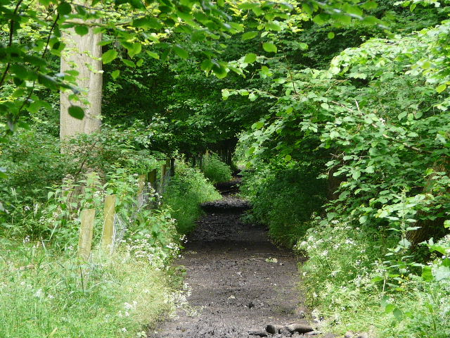
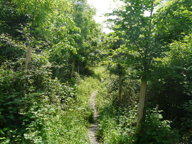
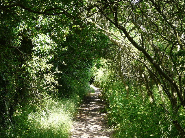
The bridleway started off as a ‘green tunnel’, with the trees and bushes either side completely overhanging the path. It was quite muddy too – there’d been a few days of rain before my last walk and then more rain yesterday, so I’d taken the precaution of wearing my gaiters today. After a while the ‘green tunnel’ ended, and the path continued between the fences and hedges of large corn fields [15], sloping up on either side of the bridleway. I noticed some White Campion growing here, as well as the fairly ubiquitous Herb Robert and Germander Speedwell. It was still wet underfoot along here, and continued to be so as the bridleway entered a long thin belt of trees [16]. After a while, the trees spread out to my left into a wood, though there were still fields a short distance away to my right. After following the bridleway for about a mile and a quarter, it turned left through the trees (a footpath continued along the valley bottom). A short distance further on it reached a track, where it again turned left. I emerged from the wood and passed a cottage and barn that were being worked on, and the track became a cement drive that went steeply uphill [17] – there were good views to the right, along the valley I’d been walking along from Fingest. At the top of the slope I reached the road that runs through the village of Ibstone.
[16]
The bridleway between Fingest and Ibstone
[17]The cement drive leading to Ibstone
Ibstone is in Buckinghamshire but borders Oxfordshire – at one time the county boundary passed through the parlour of the village’s manor house. The name derives from the Anglo-Saxon “Hibba’s boundary stone”. At the time of Edward the Confessor the village was known as “Hibestanes”. The 900 year old parish church of St Nicholas stands separate from the rest of the village.
As I turned left, I immediately passed the village Infants School – from the picture of a Red Kite on the school sign, I deduced that the teachers were very wise and the pupils very intelligent! J The after-school club was called the Kites Club, so the village is obviously proud of the magnificent birds they have flying overhead. I often see them here when I drive through, and one flew overhead now as I followed the road, passing a junction on the right. After another couple of hundred yards I took a footpath on the right, entering another wood. The path headed slightly left through the trees, which here were mainly conifers. I saw some Foxgloves growing here. The wood went downhill to my right, the path very slowly descending a little way down the slope. Further on I left the conifers and the path continued through a youngish plantation, the trees protected by plastic tubing and stakes [18]. I kept left where a path came in sharply from the right and soon reached another junction (the white arrows on a tree were a bit hard to spot), where I turned right for a few yards to reach a gate. The path didn’t go through the gate, but turned left, running between the edge of the wood and the wire fence of a huge sheep pasture sloping down into the valley on my right [19].
[18]The path through the wood between Ibstone and Turville
[19]The path between the wood and the pasture on the way to Turville
This path continued for several hundred yards, with nice views across the valley and ahead towards Turville. Eventually the path came to a stile in the wire fence, and then went across a corner of the pasture to another stile [20]. I saw an unusually adventurous sheep here – it squeezed through a gap beside a gate to get back into the pasture, and slowly dawdled off towards its companions who were several hundred yards away at the other end. The path now led through scrubby bushes, and for the second walk in a row I saw some Common Spotted Orchids. The bushes gave way to trees, and then I reached a gate. The last time I was here (on an unsuccessful mission to get decent photographs of Kites and Buzzards) I discovered an escaped Harris Hawk! The path cut across the corner of a rough pasture on a steep hillside to a pair of gates, and then continued across a large meadow [21] to reach Turville, with Cobstone Mill up on the hilltop to my left.
[20] Looking ahead towards Turville from the large sheep pasture
[21]The path approaching Turville
Like Hambleden and Cobstone Mill, Turville is often used as a setting for films and TV. In recent years it has acquired a certain fame as the setting for ‘The Vicar of Dibley’ (a pleasant enough comedy that has its moments, and written by Richard Curtis whom I greatly admire, but how on earth was it recently voted third best British sitcom ever?). When I walked through here in 2005, the signpost for the Chiltern Way was pointing completely the wrong way – I heard later that it had been put back incorrectly by a film crew. There is an interesting story relating to the church in Turville. In 1900, an ancient stone coffin was discovered buried under the floor – when opened up, it was found to contain not only the body of a thirteenth-century priest, but also that of a seventeenth-century woman with a bullet hole in her skull! (Perhaps an earlier attempt to install a female vicar in ‘Dibley’ hadn’t been quite so successful!).
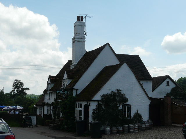
[22]The Bull and Butcher pub in Turville
As I photographed the village’s pub [22] and church, a coach pulled up carrying a load of tourists. I hurried on my way, following the lane to the school and continuing on along a footpath between overhanging hedges. These ended at a gate into a large meadow, where another path crossed – I stopped here to eat my lunch sat on a stile. The path continued on along a hedgerow on the right – looking back, there was a good view of Cobstone Mill. About halfway along the meadow, I took a path forking left through the grass and going slightly downhill to another stile and a lane. I followed the lane a short distance to the right, then continued on a bridleway where the lane went right.
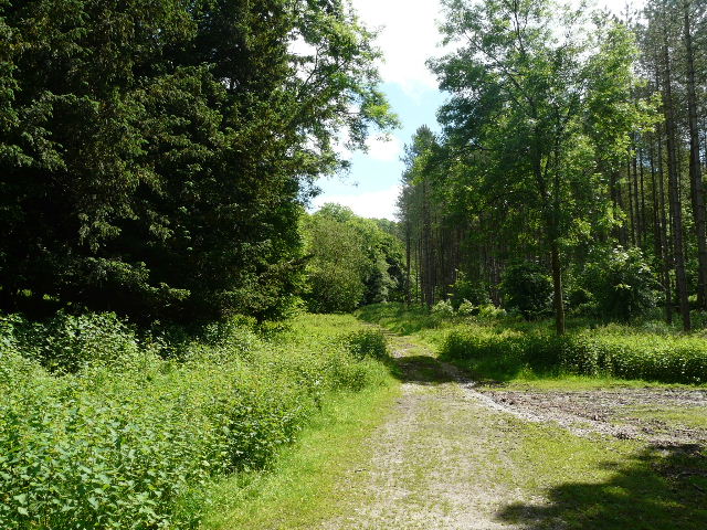
[23]The bridleway through the wood
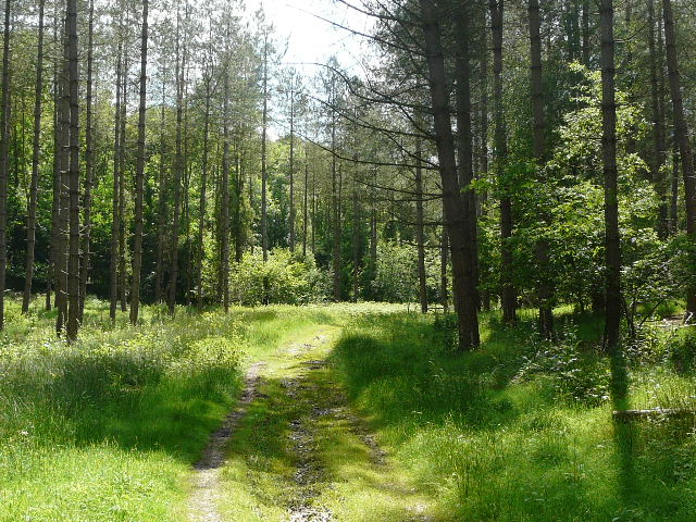
[24]The bridleway through the wood
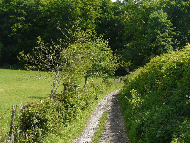
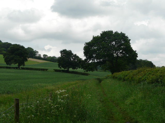
The bridleway ran through a wood, and had a very stony surface. It seemed in places that the track had been surfaced with stones or flints, but no drainage channels had been put in, so after heavy rain water had scoured quite deep ruts along the track. It was a long section through the wood [23], about a mile and a quarter. I noticed more Foxgloves, some Crosswort and some Yellow Pimpernel beside the track. It was as usual very pleasant walking amongst the green trees [24]. The track curved left and then right, but generally heading south-west, at one point having a field visible above a slight bank on the right. When I finally got to the far side of the wood I turned left, following a path uphill just inside the wood (I was briefly on the route of the Shakespeare’s Way here, which runs from Stratford-upon-Avon to London). At the top of the hill I crossed an empty pasture, to reach the corner of a lane where I continued straight ahead.
After quarter of a mile or so, I turned left on a bridleway that went past a farm and then continued between hedges, with sheep in a pasture on the left and an arable field on the right. It then entered another wood – here the way was very muddy in places as the the bridleway descended slightly, though there was usually an alternative path to avoid the boggy bits. I spotted a couple of Fallow Deer here, in the trees to my right – I’d been surprised that I’d not seen any more of them since those I saw in Ashridge on Walk 3, I usually see them far more often than this in the Chilterns. A bit further on a fallen tree completely blocked the bridleway [25], and I had to scramble up and down a bank on my left to get over and around it.
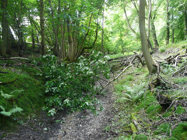
[25]Looking back at he fallen tree that blocked the bridleway
The bridleway now descended gently through mainly Beech trees, to reach a path junction near the bottom of a slight valley. Here I turned right, now following a well surfaced track with the valley bottom just down to my left and the wood (Great Wood) sloping up on my right. The trees here were now mainly conifers, and I saw several Yew trees just to my right. A bit further right, at the bottom of the valley, were some very colourful Rhododendrons [26]. The track [27] was very slightly downhill as the valley broadened out, making this a nice easy section in the shade of the trees.
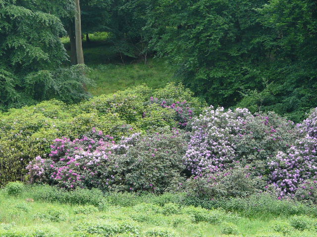
[26] Rhododendrons
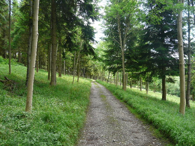
[27]The track through Great Wood
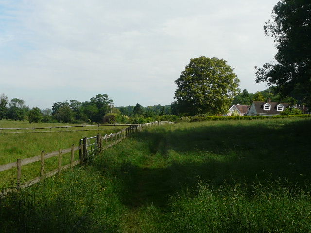
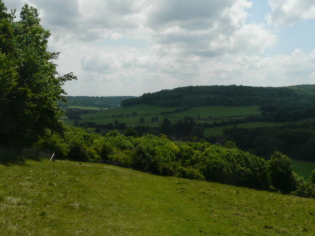
The bridleway continued beyond the end of the wood, still on a well-surfaced track which slowly followed the valley as it curved to the right. There were a few brown and white cattle in a field on the right, then a few more in a larger pasture on the left. Looking down the valley ahead of me I could see a hillside running across [28], which I knew from the map was on the other side of the River Thames. Eventually I passed a cottage on my right, and a few yards further on I turned left onto another bridleway. This started off between hedges [29] and then ran along just inside the right edge of Ridge Wood, the trees sloping up the hillside on my left. A few feet to my right were fields in the flat Thames Valley. The bridleway then ran for a few yards along a drive beside cottages on the right to reach a lane, just south of Hambleden.
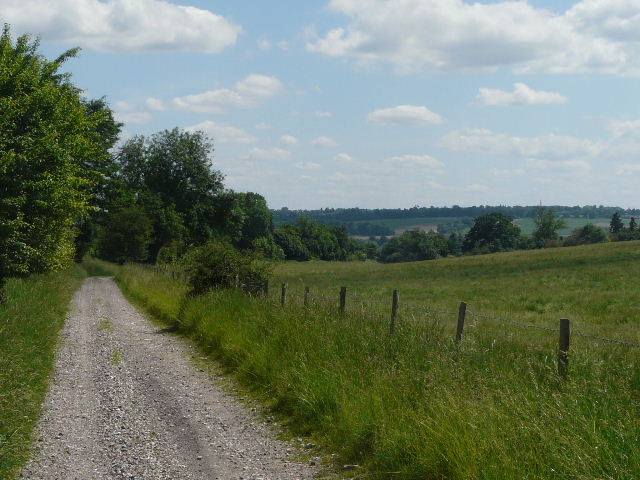
[28]The track heading towards the Thames Valley
[29]The bridleway heading towards Ridge Wood
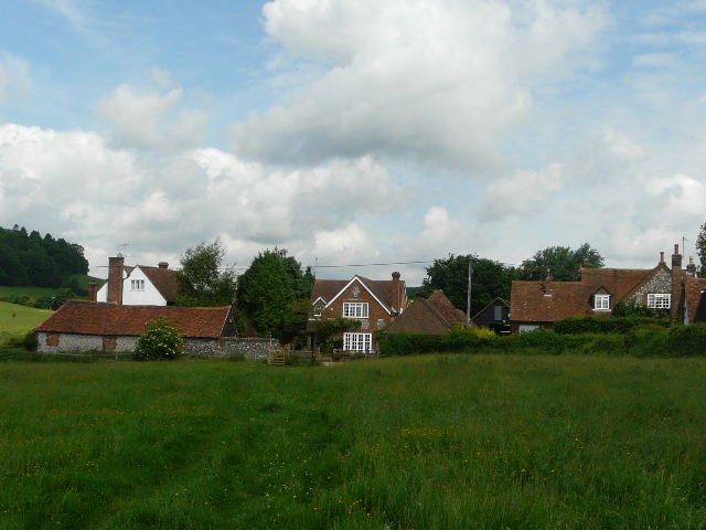
I had to go a few yards right, away from the village, before turning left along a bridleway on the other side of the lane. This was a wide track between hedges, but had several large puddles that crossed it completely. I ignored a path going off across a meadow beside the Hamble Brook, but stopped to photograph the village across the meadow [30]. I soon came to a track junction, where I turned left. It was only a few hundred yards now to where a path went left, across the end of a sports ground and back to the car park in Hambleden. It was around 3.45pm when I got back to my car, so again a very slow walk for some reason. Not really sure why.
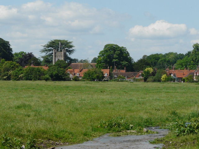
[30] Hambleden
This was a very enjoyable walk and an excellent route (if I do say so myself!). I first walked most of the route at the beginning of 2007 when I came walking here specifically because I wanted to see some Red Kites, but on that occasion I followed the direct route from Fingest to Turville (as does the Chiltern Way). It was such a good walk that I hoped to include it as it was in the Chiltern Chain Walk, but it was a little bit short for my purposes and in the end I needed to extend it out to Ibstone to link up with the next walk.
I have walked round the Hambleden area several times now, and fully understand why it is one of the most popular parts of the Chilterns. The countryside is particularly lovely here, with wide valleys rising to wooded hilltops, and there is much of historic and other interest in the attractive villages of Hambleden, Fingest and Turville.
Total distance: 186.0 miles
(To see this walk repeated IN THE OPPOSITE DIRECTION on 10/11/12, CLICK HERE)