Pete's Walks - The Chiltern Chain Walk, Walk 16
If you are considering walking this route yourself, please see my disclaimer. You may also like to see these notes about the maps and GPX files.
Google map of the walkDownload GPX file of the walk
NOTE (6/11/2025): Parking at Cowleaze Wood is no longer free, there is now a cashless payment system. To see details, click here and then click on the 'Parking and prices' tab.
Walk 16 5/06/08 – Cowleaze Wood and Ibstone (11.9 miles approximately)
Parked on road at Cowleaze Wood.
If you are interested in walking this route yourself, click here to see the route description (but only if you have already read my disclaimer and notes regarding route descriptions).
When I arrived at Cowleaze Wood this morning, I was very surprised to see that the large car park had been closed because of forestry operations. I assumed that this was only temporary (in fact it was open again when I drove past a few days later). Anyway I managed to park off the road by the car park, and started my walk about 10.10am. Unusually this was the second successive day that I’d walked, and in fact my third walk in four days – the gloomy weather forecast for the next few days had rather forced this upon me.
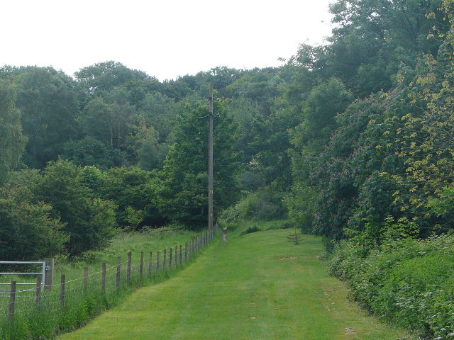
I walked through the car park, parallel to the road on my right, and continued on a path through the trees that soon joined the road. I followed the road for a few yards, then took a footpath on the right, just past the end of a belt of trees. The path went diagonally across a large cattle pasture, heading for the left end of a row of tall conifers. Some young bullocks over to the left stared at me as I went by – most of them were lying on the ground, which is meant to be a sign of impending rain, but it was a nice bright morning. The path then went downhill through a small area of wood to a kissing-gate.
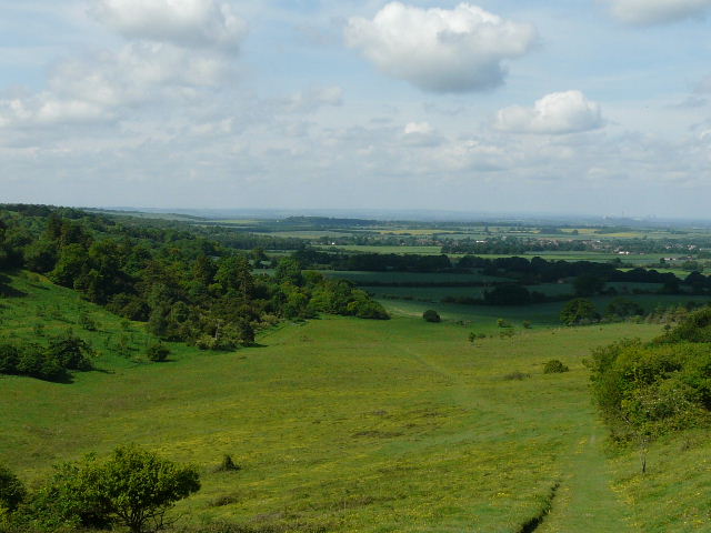
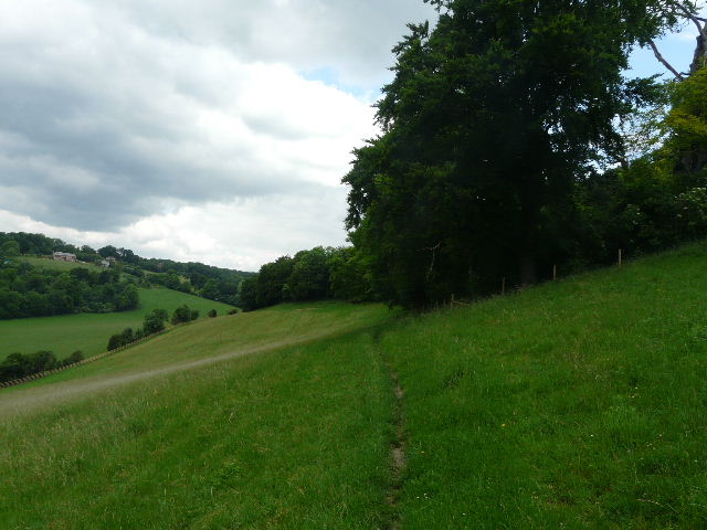
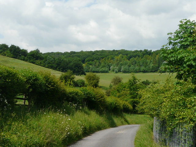
[1]The path descending towards the Oxfordshire Plain
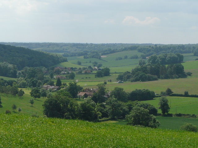
A wonderful view now opened up, as the path descended at a steady gradient down the northern escarpment of the Chilterns, with the Oxfordshire Plain spread out before me [1]. Curiously, the path seemed to be aiming directly at the distant eyesore of Didcot Power Station. The downland that I walked through here was studded with many bright yellow flowers – not the usual buttercups (although there were a few of these) but mainly Common Rock-rose, which I’ve never seen before in such profusion.
[2] Looking back from near the bottom of the hill
[3]The path along the foot of the Chiltern escarpment
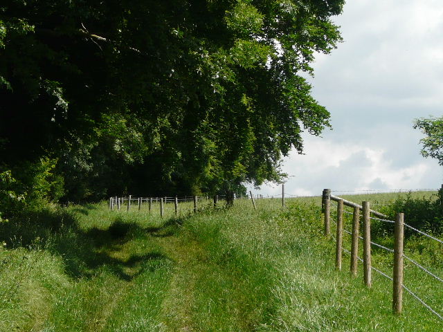
At the bottom of the slope [2], I went through a kissing-gate and followed the path along the bottom of the hillside, between a wood on my left and the wire fence of a corn field on my right [3]. From previous walks I knew that the Ridgeway ran along behind the hedge on the far side of the field. The path turned right and then left, still following the edge of the field, and eventually reached a gate. Beyond this the path continued with bushes now on either side [4]. I spotted a Red Kite nearby as the path contoured round the bottom of the hillside sloping up to my left.
[4]The path towards Pyrton
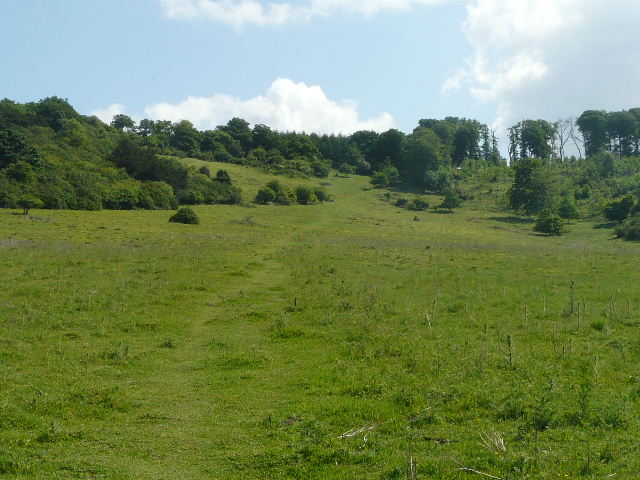
[5]The start of the path up Pyrton Hill
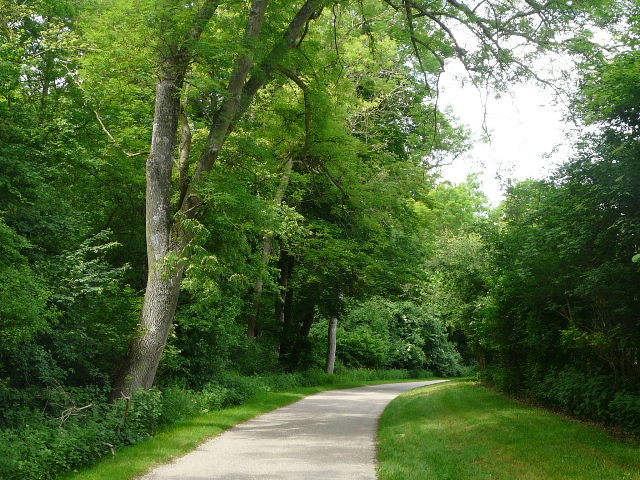
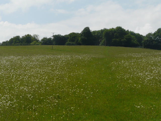
The path ended at a surfaced drive, where I turned left, joining the route of the Oxfordshire Way (I’ve no plans to do all of this long-distance path, as much of it is more than an hour’s drive from my home). The drive went past a timber merchant, a cattery and Pyrton House, all on the right. Where the drive ended, the path continued ahead, initially on a broad strip of grass [5], heading quite steeply up the wooded slopes of Pyrton Hill. The path followed a fence on the left, the grass strip soon being replaced by bushes and trees. I paused to take a photo looking back over the Oxfordshire Plain [6], then continued on up through the trees and bushes. It wasn’t too far before a meadow or pasture started on the right – here I went over a stile and followed a path going half-right, continuing on the Oxfordshire Way as the path followed the right edge of the field [7] to reach a road just outside Christmas Common.
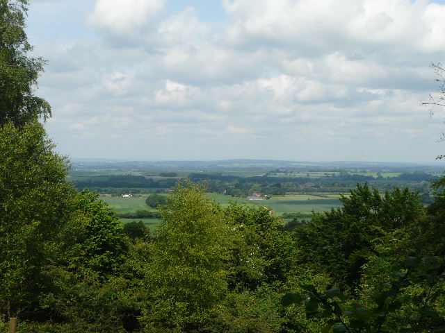
[6]View over the Oxfordshire Plain from the path up Pyrton Hill
[7]The path towards Christmas Common
According to Wikipedia Christmas Common takes its name from the Christmas family who were once local landowners. However another version is that it takes its name from an event in 1643 during the Civil War, when the Parliamentarians held Watlington while the Royalists defended the ridge on which the village was situated. A truce was declared for Christmas Day, and both sides met and socialised here during the festivities. The small village church was built in 1889, and is now a private residence (complete with gravestones in the garden).
I followed the road to the right (Cowleaze Wood was a mile or so to the left), soon passing a turning to the right (my next walk will start at a car park about quarter of a mile down that road, on Watlington Hill). I kept on the road as it turned slightly right where another road forked left. I passed a few houses and the Fox and Hounds pub on my right, then turned left on a footpath, with the converted church on my right. The path ran through Queen Wood for a short distance, ending at a path junction by a garden fence, where I followed a driveway a few yards to the left to reach a lane. I turned right along this lane, with tall hedges or fences either side, until I reached a bridleway going left after about 200 or 300 yards.
[8]The start of the long bridleway from Christmas Common
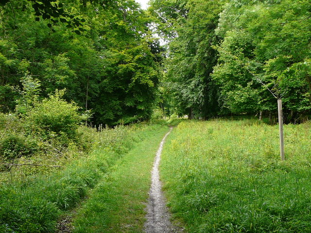
The bridleway [8] descended through another wood, Prior’s Grove, before turning right to follow a valley bottom. This was still wooded, at some point becoming Fire Wood. The bridleway, part of the Oxfordshire Way again, was a little muddy in places but not too bad. It was almost imperceptibly going downhill as it followed the bottom of the widening valley [9]. The wood was quite mixed, some parts being predominantly conifer, other parts being more like typical beech woods. There was some Red Campion here, as well as the more usual wildflowers. I came to a crossing path, part of the Chiltern Way, where the Oxfordshire Way turned right but I continued straight ahead. This was a lengthy but pleasant and easy section of the route. I was now close to the edge of the wood, and could see through the trees to fields on my left.
[9]The long bridleway from Christmas Common
[10]The bridleway approaching Turville Park Farm
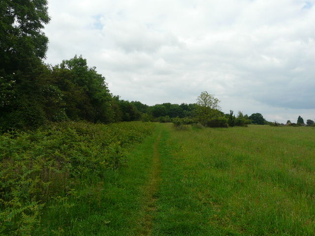
After following the bridleway for about a mile and a half, it finally emerged from the woods. There was still a line of mature trees to my left, while on the right was an empty pasture or paddock. I noticed that the gate in the wooden fence on my right was wide open here. The bridleway curved round to the right, following the edge of the same field and now with another wood on the left [10]. I passed a small enclosure on the right containing numerous young calves, then passed Turville Park farm, where a tanker was delivering fuel. The farm drive soon turned left, but the bridleway continued ahead, still following the winding valley bottom. There was a large field with young calves on my left, and then the bridleway followed a mature hedge on the left of a large corn field which sloped up to a wood on my right. After a few hundred yards, the bridleway switched to the left of the hedgerow [11], where there were now further corn fields.
[11]The bridleway shortly before I turned left
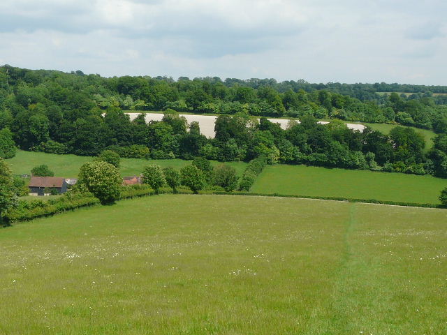
[12]The Stonor Valley
[13]The path continuing towards Turville Heath
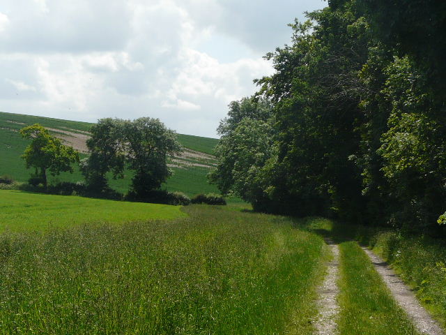
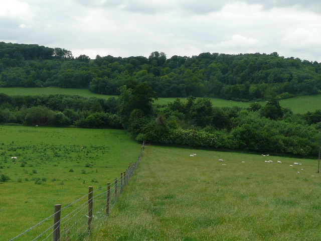
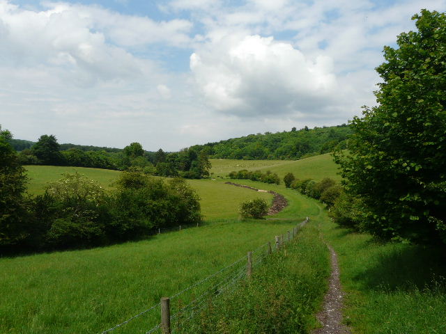
A bit further on I reached a crossing path, where I turned left and followed a wide track going steadily uphill between two corn fields. At the far side of the fields, near the top of the hill, there was a bench and a picnic table by some trees, obviously put here because of the views. To my right was the Stonor valley [12], and I could see where I’d crossed it on the Chiltern Way. Looking back and left I could see the largely wooded valley that I’d just followed for about two miles. I continued on my way, now on a wide track between hedges and fences [13], with cattle pastures to my left and arable fields on my right. At a point where the track turned right, I went through an old iron kissing gate and continued across the corner of a large pasture – this was dotted with a few old trees as if it had been the parkland of a great house at one point, and there were a few cows some distance to my left. The path continued across a meadow, where some sheep and goats were sheltering under a tree [14]. The next meadow merged with the gardens of a house, the path keeping to the long grass and passing between the lawns on my left and a grand old beech tree to reach a kissing gate. The path then followed the drive of the house a few yards to reach a minor road by a junction.
[14]The path towards Turville Heath
[15] Looking back at Turville Heath
I crossed over and followed the lane ahead of me, with trees and bushes on either side. After a hundred yards or so another lane came in on the right, and here I turned left onto a bridleway. I followed it the short distance through the trees and bushes of Turville Heath, bearing slightly left through an area of grass as I reached the hamlet of the same name [15]. A fingerpost indicated where the bridleway continued, going steeply downhill between hedges at first and continuing downhill through a beech wood (looking on the map, this may be part of the rather interestingly named Idlecombe Wood). The path curved right then left, leaving the wood and running between hedges again, with sheep pastures either side, to reach a lane where I turned right.
[16] Looking back from the path to Ibstone Church
[17]The path to Ibstone Church
I soon came to a path junction, where a footpath crossed the lane and another bridleway went half-left – this was the route I followed. The bridleway went through more woodland, bearing right at a junction. A few yards further on, I forked left onto a footpath. This crossed the drive of a farm (just to my left) and exited the wood at a stile. I now followed a wire fence on my right, which separated two sheep pastures complete with cute lambs. I was now heading steeply uphill [16], and to my right I could look along the valley towards Turville where I’d been yesterday. Over a stile, I continued alongside a hedgerow and then a wood on my right, a large meadow of tall grass now sloping down into another valley on my left [17]. The path levelled out as it ran beside the wood, and after a while it went over a stile and climbed steeply through the woods for a short distance. It soon turned sharp left and levelled out – at this point I took a very short detour into the adjacent churchyard to photograph Ibstone Church [18].

[18]Ibstone Church
The fairly level path then continued through the wood. After a few hundred yards I came to a path junction where I turned right, leaving the wood and crossing a large paddock to reach a junction where the lane from the church reached the road through Ibstone. I followed the road to the left, almost immediately passing the village school on my right (wise teachers and intelligent pupils who obviously appreciate the local Red Kites!) [19]. After about a quarter of a mile I turned left on a path between wooden garden fences, which soon reached the same wood and same path I’d been on before, where I turned right – the slight detour in and out of Ibstone was an admittedly somewhat contrived way of linking this walk to the previous one, but didn’t really detract from the quality of today’s walk.
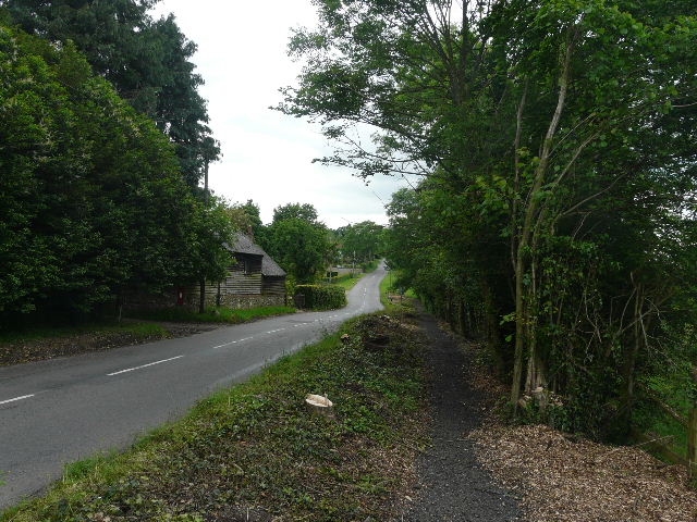
[19]The road through Ibstone
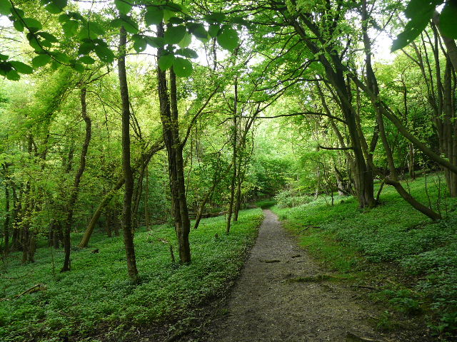
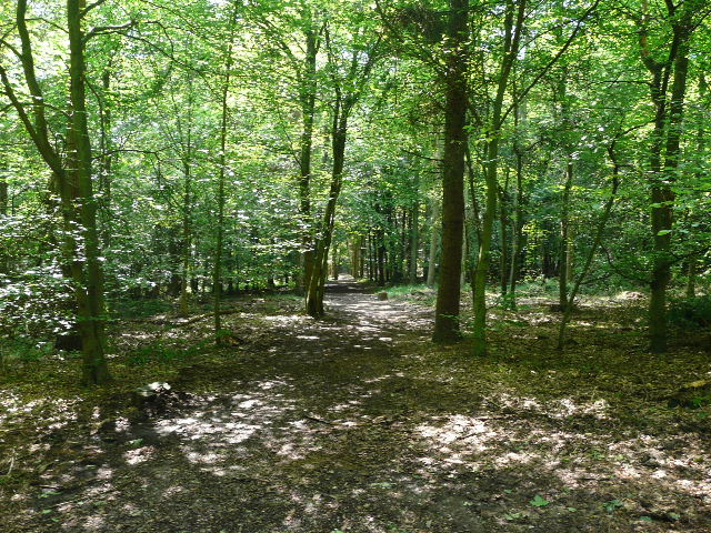
[20]The path near Ibstone
The path now continued for some distance through the wood [20], very gradually descending into a small valley on my left. When it reached the valley bottom, it turned left up the opposite slope, with the fence of a field close by on my left. This was a steep but short section, soon emerging on a lane or drive in another part of Ibstone. I went a few yards to the right, to where the large grassy expanse of Ibstone Common started on the left, and turned left on a bridleway. This runs along a drive between the common and garden hedges on the left, then passes through a small area of trees and crosses another drive, before following a hedgerow beside the common on the right. I took a short detour here across the common, to eat my sandwiches on a bench beside the village cricket pitch.
[21]The bridleway beside Ibstone Common
I returned to the bridleway along the edge of the common [21], noticing the large stone in the middle of the common (I’ve not been able to find anything out about it, but I don’t think it’s the original boundary stone that gives the village its name). Where the edge of the common curved to the right, I went straight on into a wood. Within yards I reached a path junction, where I turned left onto a bridleway. A notice announced that I was entering the Wormsley estate, and the bridleway descended quite steeply through the wood, the path being a very narrow chalk gulley [22]. Initially I was on the Chiltern Way again, but about halfway down the hill this forked left onto a footpath (I remember missing this junction once!). The bridleway curved right, and emerged from the wood near the bottom of the slope [23], continuing on a good track along the bottom of a broad valley.
[22]The path descending from Ibstone
[23]The path through the Wormsley Valley
The track soon ended at a sharp corner of an estate drive, the right of way continuing along it in the same northerly direction. There were some mature trees beside the drive [24], and then a wood on the right. I passed a farmyard and a thatched cottage on the left, and then turned left on a bridleway rising uphill through another wood. This was quite a lengthy but reasonably gentle climb – as this was my third walk in four days I was a bit more tired than usual, and had been counting down how many more short ascents I’d got left. The path levelled out soon enough, and it was a very pleasant section through the trees of Langleygreen plantation [25].
[24]The drive through the Wormsley estate
[25]The path through Langleygreen Plantation
When I reached a crossing footpath, I turned left. The path descended quite steeply for a very short distance, before turning slightly to the left and thus easing the angle of descent through the trees. It emerged from the wood, and continued downhill at an angle, now crossing a meadow. In the valley bottom, I passed to the left of Lower Vicar’s Farm to reach another drive [26]. I turned left for a few yards, before going over a stile in the hedge on my right. The path went uphill through a huge meadow – I was relieved that it wasn’t quite as steep as I remembered it, but it looked even further than I’d expected to the far side [27]. It was just a matter of plodding steadily onwards and upwards, and I resorted to my usual trick in such situations. I started to think about a certain manager from my days at BT, a really unpleasant and incompetent individual who used to make totally ignorant and completely inaccurate remarks about my work. Thinking about him always makes my blood boil and the adrenaline flow, and I find I get up the hill almost without realising it! It certainly worked today - as I came out of my angry reverie, I was amazed how close I was to the top of the meadow [28].
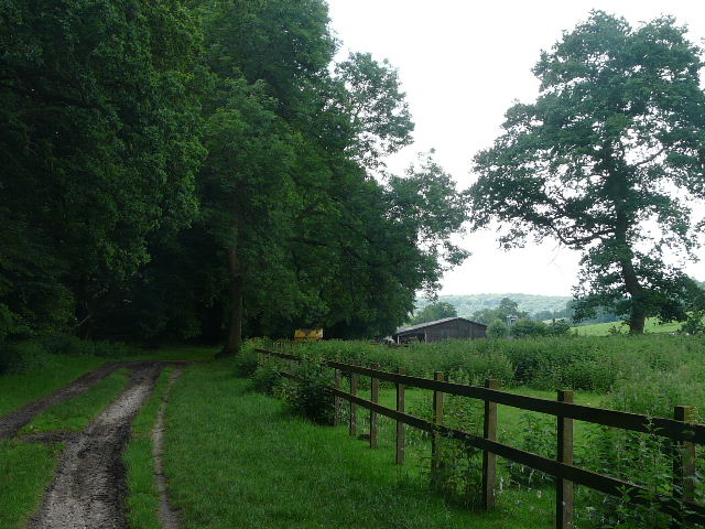
[26]The drive near Lower Vicar's Farm
[27]The path through the meadow to Cowleaze Wood - as usual, it was much steeper than it appears in the photo, honest!
[28]Looking back from the path to Cowleaze Wood
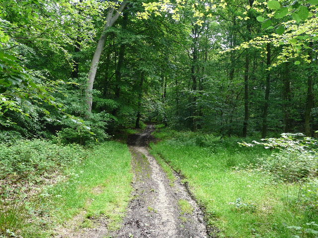
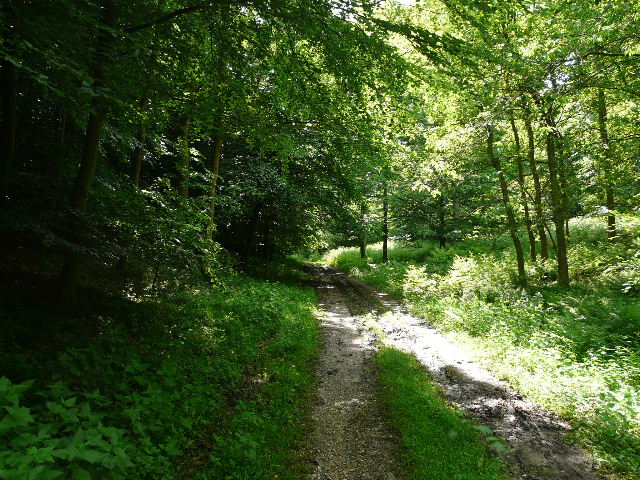
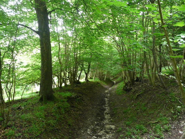
I went through a gate and entered Cowleaze Wood. Almost immediately I met a woman coming the other way with a St Bernard dog (I’d see her again later, along the road just after I’d started my drive home). There was clear evidence that there really was forestry work going on here, with branches and logs left lying on the ground amongst the conifers. I followed the path [29] through the wood, looking out for the sculptures that are located here. Or at least they were – I went past one, which consisted of two triangular cement columns. I was sure that when I first went past here (last October, on one of my exploratory walks) there were some images on each of the sides of the columns, but now they had gone – I could see the rectangular spaces where they’d been [30]. I wondered whether the images have been stolen or vandalised, or just temporarily removed for protection while the forestry work is carried out (in fact I’ve just checked on the internet, and the sculptures have been removed due to a lack of funding!). It was a straightforward half-mile walk through the wood and I was back to the closed car park and my car parked on the road.
[29]The path through Cowleaze Wood
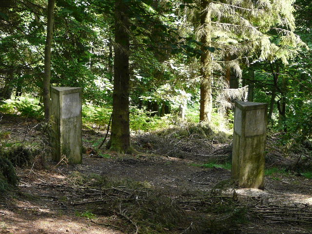
[30] Remains of an artwork in Cowleaze Wood
I was a little tired today, so didn’t quite enjoy the walk as much as I should have done. But it was still very enjoyable, and like yesterday’s walk I think it is an excellent route. Also like that walk, when I first walked round this area on an exploratory walk, I thought it such a good route that I’d like to include it unaltered in the Chiltern Chain Walk, but in the end had to alter it slightly to link in with the other walks. My original route had taken a more direct path from Turville Heath to Ibstone Common, but I had needed to extend it out to near Ibstone church to link with Walk 15.
I don’t think I’ve been doing the walks justice, really – I’m sure these journal entries are not as enthusiastic about the walks as they should be. The problem is that I first did some exploratory walks to help work out where I wanted the Chiltern Chain Walk to go, and then did each of the twenty walks in the ‘wrong’ direction (clockwise or anti-clockwise) in order to check the details of the route and to determine which direction was best for each walk. While I still think that I needed to do that (I actually made a couple of slight changes to the route), it means that I’ve done most of these walks a couple of times already, in one direction or another. So I am not seeing them through a fresh pair of eyes, and so am not as enthusiastic about them as I should be. I can only say that when I first did this walk (as I say, very slightly different to today’s walk) I thought it was absolutely brilliant, and could hardly imagine a better walk in the Chilterns! Admittedly, it was October when the autumn colours were near their best, but I still think that this is an exceptional walk. There are great views from a number of places, lots of ups and downs, a large percentage of the walk is through very pleasant woodland, with enough field paths to add variety, and it passes through some attractive and interesting villages and hamlets.
Total distance: 197.9 miles
(To see this walk repeated IN THE OPPOSITE DIRECTION on 2/2/13, CLICK HERE)