Pete's Walks - Hertfordshire Chain Walk
If you are considering walking this route yourself, please see my disclaimer. You may also like to see these notes about the maps and GPX files.
Walk 10 2/11/06 Moor Green (5 miles each way)
Parked in lane in Moor Green.
This was another beautiful autumn day with hardly a cloud in the sky. We didn’t have the frost that was forecast, but it was a close thing as the thermometer in my car said it was only 3C as I drove off from Kensworth. I set off later than usual, about 9.30 or 9.40, as I knew this was only going to be a relatively short walk. Originally I’d intended to combine this leg of the Hertfordshire Chain Walk with the next leg (which is even shorter), but I was feeling a bit tired this morning (this would be my third walk in four days) so I opted to just walk this leg on its own. In any case, I didn’t want to overdo things – my back has been playing up a bit recently, and I’m off on a four-day walking holiday next week.
The hamlet of Moor Green [1] consists of a handful of houses scattered round the edge of a large green with a minor road running through it. It is in quite a remote part of Hertfordshire, between Stevenage and Buntingford, and I had to drive for many miles along minor roads and country lanes to reach it. It is such a small place, it wasn’t even marked on my parent’s road map which I checked last night to plan my route here. I parked beside the green, close to a footpath sign indicating the route I’d be using to return here.
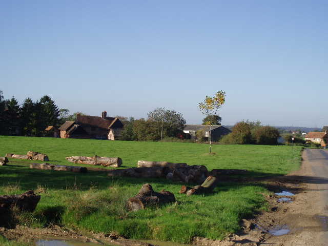
[1] Moor Green - the logs show where the path has been diverted
I walked a few yards along the lane through the green, then turned left along a drive towards a former farmhouse, the start of my walk being in a north-easterly direction. Before reaching the house, I turned right on a path between a right-hand hedge and a wire garden fence, and went round two sides of the house’s garden. The path lead into a grassy field, where I continued alongside the garden then turned half-left to cross the field diagonally behind the farmhouse. This field had lots of hollows and mounds, including what looked like the dry remains of a moat, but nothing was marked on the map. On the way back, I saw a group of Fallow deer through a gate into the field on my right. The path went through a gap in the hedge to another grassy field, and continued in more or less the same line to the corner of a wood. It followed the edge of the wood (on my right) for a few yards, before turning half-left towards the opposite hedge. There was a redundant kissing-gate in the field here, which I couldn’t resist going through. On reaching the hedge, I crossed a stile to reach Back Lane [2].
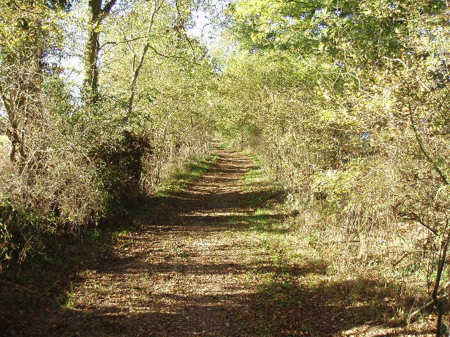
[2] Looking back along Back Lane
Back Lane is a Roman road according to the map, running in a typically straight line for several miles, heading south-east towards the site of a Roman town that is marked on the map near the A10 (which here follows the course of the Roman Ermine Street) between Puckeridge and Braughing. Back Lane is now a wide track running between hedges, a bit muddy in places but generally very pleasant to walk along. I turned right and followed Back Lane for about 500 yards. On reaching a wooden post with waymarks, I turned right off the Roman road and followed a farm track beside a left hand hedge, now heading south or south-west. In the field corner, I went through a kissing gate into a corner of a large cattle pasture. After a few yards I went through another kissing gate that gave access to a causeway across some muddy ground to the left of a pond – the causeway was being constructed at the time the guide book was written, and it was just as well that it was built because the mud between the causeway and the pond was so deep that it would have been clearly impassable. Beyond the short causeway I continued on through another thin cattle pasture, going slightly uphill. There were no cows here, but as I got near the top of this field, the hedge on my right ended and I could see the cows in the larger area of pasture on the other side.
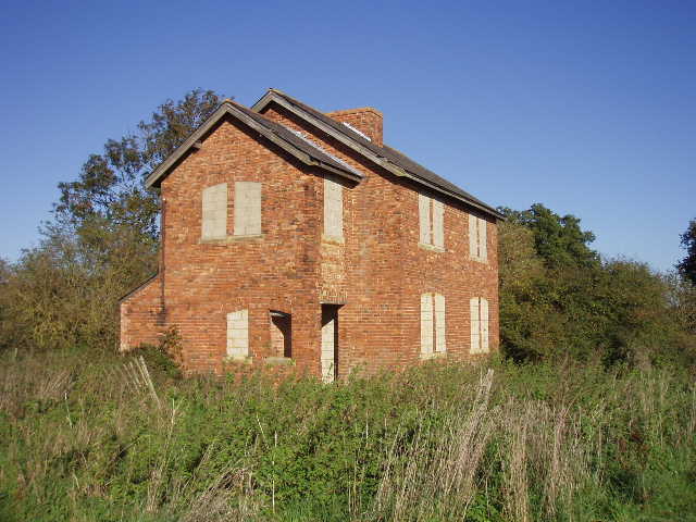
[3] The abandoned house
The path has obviously altered here, because at the top of this field I went through a stile with a waymark that was to the left of an abandoned house [3]. The guide book talks of going through the garden to the right of the house, and that was how it was shown on my map. The abandoned house had all its windows filled in with breeze blocks but looked in fairly good condition, although there seemed to be a crack in the brickwork in one wall. I walked on along a track beside a large field for a few yards, then went over a stile in the right hand hedge. There was no sign of the path through the next field, so I followed the instructions in the guide book (confirmed by my map) and walked across the middle of the field (recently planted with some arable crop), and then went towards a gate in the far left corner. Here I reached a road, which I followed to the left for few yards, then took a path on my right (I had to climb over a low metal gate). This was a large sheep pasture, which I crossed diagonally half-left. The path then went down a short track between fences, with a kennels on the right, to reach a road in the village of Wood End. I turned left here, noticing that there were several very attractive old houses here. I went straight on at a junction where a road came in from the left – the guide book mentioned the old chapel here, but what I noticed was a beautiful old half-timbered house (the chapel seemed to have been built onto the side of it).
I turned right to pass through a farmyard to a gate, where I turned left to reach a stile. I crossed the next field, another sheep pasture, half-right to a gate in the hedge. Here again the path has changed, as the guide book and map indicated that I had to go through the gate (again I actually had to climb over) and turn left alongside the hedge, whereas a waymark seemed to indicate that I stayed on this side of the hedge. In the field corner, where I had to turn right alongside a wood, there was a kissing-gate in the hedge so on my return trip I walked up the other side of the hedge (perhaps I’m going to have to invest in all these recently republished maps!). I followed the edge of the wood to a stile in the next field corner, and kept following it as it went slightly left in the next sheep pasture. I went across another stile at the next field corner (I would sit on this stile to eat my lunch on the way back) then crossed a brick bridge over a dry stream bed to reach a large ploughed field. I turned left along the edge of this field, and then right at the next field corner. At the next corner, I reached a farm track I’d walked on the previous walk, where I turned right (so I walked three sides of the same field).
[4] View back from the farm track shared by Walks 9 and 10, looking towards Haultwick
This well-surfaced farm track went uphill quite steeply at first, with a hedge on the left, then switched to the right of the hedge and continued uphill at a much gentler gradient. As I’d found yesterday, the views along this stretch were very good indeed, as I gradually reached a high point where two rights-of-way crossed. All around me the fields (ploughed, grass or recently planted arable) descended into dips in this undulating landscape, then rose again. Everything looked very green in the bright sunlight, with the changing leaves of the trees adding a touch of colour to the scene. There were many woods in view, and a few cottages and farms dotted about the countryside – on my way back, I could make out the locations of Green End and Haultwick where I walked yesterday [4]. These were the best views I’d have all today, as this walk didn’t have anywhere near as many good views as the previous walk had.
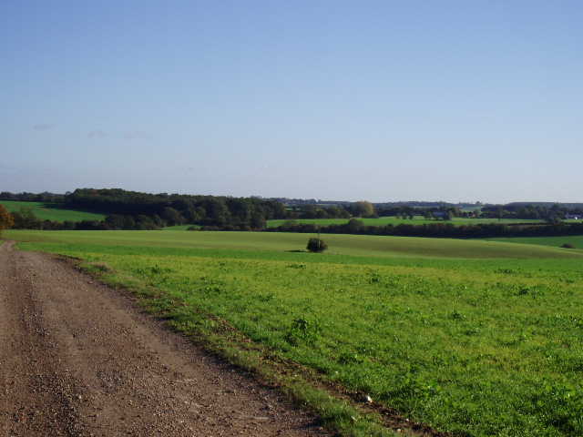
At the path junction, I turned right (leaving the route of Walk 9) on a path across a field of root crops. Across a stile in the far hedgerow, I turned left and followed the hedge round two sides of the next field (arable) to another stile by a large tree. The path across the next field hadn’t been cleared, but there were several footprints marking the way (just as well, as when I came back the other way it wasn’t possible to see the stile from the other direction until you’d almost reached it). I then followed a broad grassy track – this next little section was a bit confusing (the description in the guide book is clearly out of date), as the track intertwined with a drive to an isolated thatched cottage, switching from one side to the other a couple of times, but I soon came to a path junction by a brick bungalow. Here I turned left on a good well-surfaced track – the guide book mentioned an alternative route along a parallel footpath to my left as this track was popular with 4x4 drivers and so could be very muddy, but this problem has clearly been resolved as the track was fine. After several hundred yards, I turned right along another good track [5] between hedges which soon brought me to Muncher’s Green (one of the best names I’ve come across on my walks!) – this was not a hamlet, but simply a small green surrounded by hedges with the track going through it. The map showed a building on the right, but this didn’t appear to be there anymore. The track continued ahead through a very muddy section, and soon ran across the green at Moor Green to reach the lane near where I’d parked (the route had been diverted a few yards to the left here, as the original route had become so muddy).
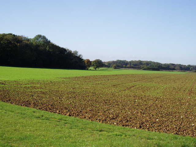
[5] Countryside near Moor Green
It had taken me about 20 minutes longer to walk this route than it did to walk yesterday’s route, which was half a mile shorter. I wasn’t at all surprised by this – the difference was entirely due to the fact that this leg of the Hertfordshire Chain Walk required a lot more navigation than the previous walk. This walk was mainly on footpaths and went through a large number of fields where I needed to check the guide book or map quite frequently, whereas the previous walk was mainly on long sections of bridleways where the route was always quite clear and required little navigation. Pondering the differences between the route shown on the map or in the guide book and the physical path on the ground also slowed me down in a couple of places.
I turned round and walked the loop in the opposite direction. Again the best views were definitely on the section of farm track shared with yesterday’s walk (I saw a Red Admiral butterfly there). I had lunch (corn beef and pickle rolls, one of my favourites!) on the stile near the brick bridge and got back to my car about 2.05pm. The walk back took appreciably less time, as I no longer had to keep stopping to look at the map
This was another perfect day for walking, with hardly a cloud in the sky and the countryside looking at its best in the bright sunshine. This walk was fine, but not as good as yesterday’s. There weren’t the same views, as the route was generally on flatter ground, and the views were usually restricted by hedges on one side or the other. Also, as I’d realised from reading the guide book and studying the map last night, it was a rather fiddly route through many small fields which would require a lot of navigation (so will the next leg, which was another reason I decided not to do the two legs together). But it was still a perfectly good walk – the Roman Road added a little historic interest, and it was curious to see the abandoned house out in the middle of nowhere.
Total Distance: 60.5 miles (each way)