Pete's Walks - Hertfordshire Chain Walk
If you are considering walking this route yourself, please see my disclaimer. You may also like to see these notes about the maps and GPX files.
Walk 9 1/11/06 Green End to Haultwick (5.5 miles each way)
Parked in lane in Green End.
Today was the first day of November, and the new month has brought a change in the weather. A total contrast compared to my previous walk! Then it was grey and overcast all day, but very mild. Today it was gorgeous sunshine and bright blue skies, but much, much colder. We didn’t have a frost this morning, but we couldn’t have been far off having one (one is now predicted for tonight). So I took my lightweight waterproof jacket and my light weight fleece out of my rucksack this morning (having carried them all summer and thus far into autumn) and wore my warm Paramo waterproof jacket instead. It was an absolutely beautiful day, the sort of day that reminds me why autumn is my favourite season. The fields were still very green and so were many of the trees, though most had changed to various shades of yellow, red and brown. Everything in the countryside really looked at its best in the bright sunshine.
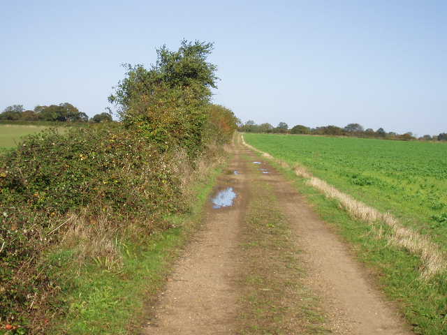
I set off from my car at about 10.15am, following the lane through Green End and heading initially in a westerly direction (this leg of the Hertfordshire Chain Walk, like most, goes clockwise). Where the lane turned left by the last cottage, I took a track forking half-right, and after about 300 yards forked right again on another track. This track between hedges was a little muddy at first, but became well-surfaced with stones as it started to descend quite steeply into a valley. As the bank and hedge on my left gradually became lower, I started to get good views of the valley [1,2]– I’d walked there on the previous walk, it was where the sheep were. In fact, I could see the sheep all moving in two long lines towards where I’d talked with a horse rider. The track took me down into the valley and across the Old Bourne (the dry river bed I’d walked next to on the previous walk) to a gate. Through this, I now walked parallel to a right-hand hedge, retracing my steps from that last walk (this was the field were I first saw some sheep on that walk). The sheep were still walking in two lines through this field into the next one – that field had been empty two days ago, but now the gate into it was wide open and many of the sheep were heading into it. I entered it as well, following the right-hand fence along the valley bottom to reach the gate where I’d talked to the horse rider. In fact, I could see a horse rider a few hundred yards ahead of me in the next field who looked like the one I’d met.
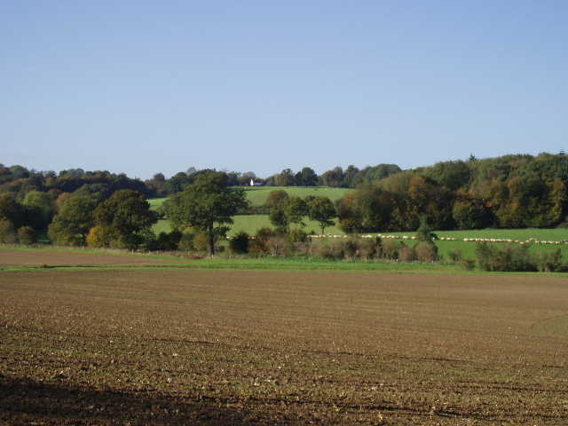
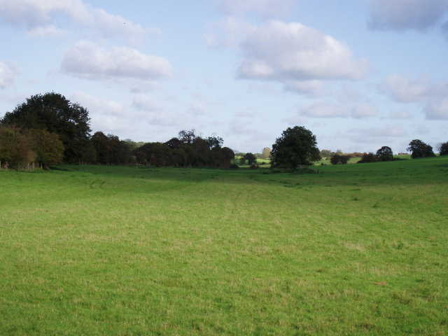
[1] Valley between Green End and Hebbing End
[2] Valley between Green End and Hebbing End
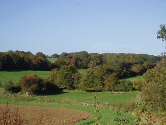
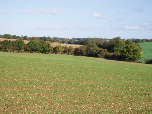
This gate was at a cross-road of paths – Walk 8 came down the bridleway on my left from Hebbing End and then went the way I’d just come. Today’s walk turned right here, to cross a footbridge over a dry streambed and then climb a steepish hillside beside a right-hand hedge. I was now heading north-east. I stopped halfway up the hill to take photos – the countryside here was lovely, but then it was throughout the walk [3,4]. At the top of the hill, the path entered a small copse – the path here wasn’t too clear, but I managed to find my way out to the other side. The path continued on, now following an intermittent hedge on the left. Again, the views here were lovely – large fields, either root crops or recently planted arable, hedgerows and woods, occasional farmhouses and cottages, all in a nicely undulating landscape. The path soon reached a good farm track, where I turned left and then followed the track as it turned right (north) beside a hedge on the left. There were a few puddles here but the track was generally dry.
[3] Countryside near Hebbing End
[4] Countryside near Hebbing End
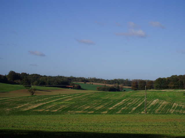
After a few hundred yards, the track [5] came to a junction with a similar crossing farm track, with a footpath continuing ahead across the next field (part of the route of the next leg of the Hertfordshire Chain Walk). I turned right here, and followed the track for several hundred yards as it descended slightly – the junction had been close to the highest spot in this area, so there were good views all round [6]. The track twisted right and left, then descended more steeply into a valley. At the valley bottom, it turned sharply right (the next walk comes in on a footpath on the left here) and soon reached a lane. I turned left along the lane, soon meeting a horse rider, and after a few hundred yards took the second path on the right. This was a very nice bridleway that ran between hedges [7]. It occurred to me that this is a fantastic area for horse riders, as there are miles and miles of bridleways – indeed the rider I spoke to on the last walk said she rode 15-20 miles in a day. I could easily see how she could do that almost entirely on bridleways with very few sections on roads or lanes.
[5] Farm track heading towards crossroads where Walks 9 and 10 merge
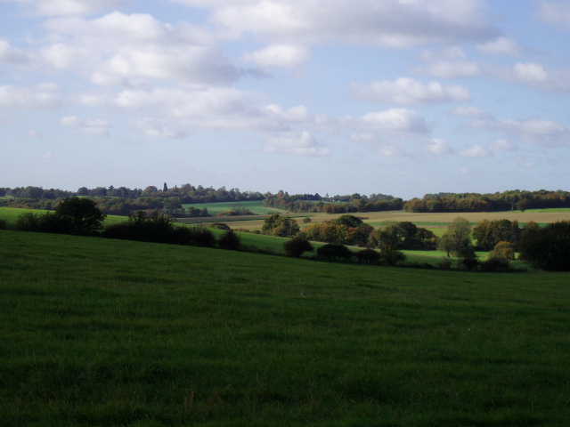
[6] View from the next farm track
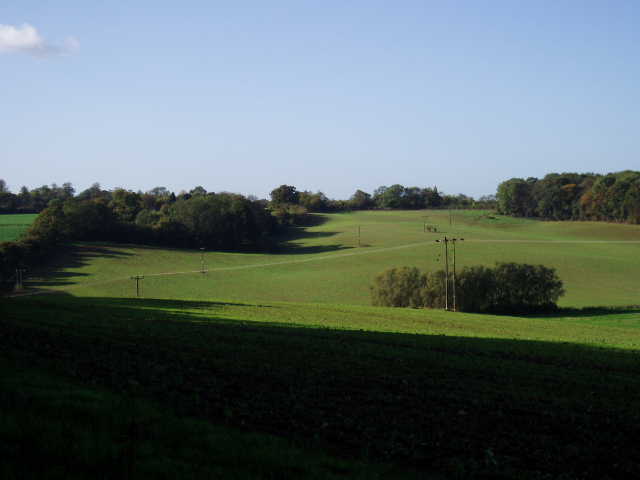
After a few hundred yards, I turned right through a gate by a cattle grid. I passed some farm buildings on my right, and shortly turned right through another gate (the map and guide book mentioned a moat here, but I didn’t see it at all). I was now heading south-west, the direction I’d be going all the way back to Green End. The guide book has a little sketch to explain the next section of the walk, but in fact it was unnecessary as there was a clear path across the next two fields (both some sort of root crop). The first of these was being sprayed with something when I came back, and I noticed a strange smell. Beyond these fields, the path entered a green lane between some trees, and after passing a junction to the right soon came out on a residential lane in the village of Haultwick (which is apparently pronounced Artic by the locals). Where the lane ended at a T-junction, I turned left and soon reached a footpath sign on the right – almost opposite there was a cottage with some very delicate and attractive plasterwork (I think it’s called ‘pargetting’) including panels that were patterned like sea shells.
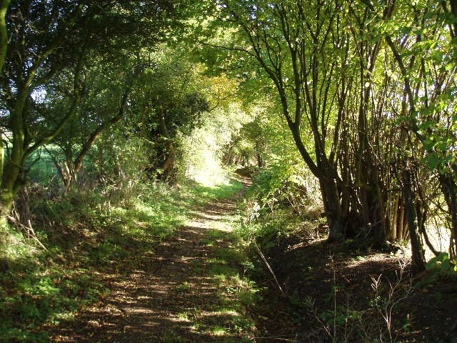
[7] Bridleway near Haultwick
[8] View from just south of Haultwick
The footpath went down a drive beside a house, then alongside the right-hand hedge of a small grass field to a stile [8]. It then went half-left across the corner of the next much larger grassy field (again, great views of the very attractive countryside here) to cross another stile. It then turned right immediately, to follow the hedgeline for several hundred yards through the next two fields. When the hedge reached a group of tall trees, the path went slightly right across a grassy area next to a playing field, then crossed the playing field to a gate [9]. Here it joined a short lane amongst the houses of Green End [10], and after a couple of left turns I was soon back at my car.
[9] ooking back from edge of Green End
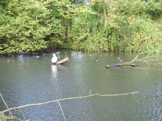
[10] Duck pond in Green End
This walk was much shorter than usual, and it had only taken me an hour and a half to walk the 5.5 miles. A problem with doing a chain walk is that I can only sensibly break it into sections of either one or two loops, so some walks are going to be a bit short like this one while others will be about 18 miles, close to the maximum I’d like to do. I turned round and walked the circular route in the opposite direction. This was uneventful, but extremely pleasant on such a gorgeous day in beautiful surroundings. Again it took about an hour and a half, so that I was back at my car again by 1.15pm – after taking my boots off, I sat in the car eating my lunch before driving home (now I think of it, I was a bit daft lugging my lunch around for 11 miles - I could have left it in the car!).
I think this was a fantastic walk, although a little shorter than I’d normally do. There was nothing outstanding on the route, nothing of historic interest, but it was just a lovely walk through pleasantly undulating English countryside, almost entirely on very good paths with very little trouble over navigation. There were great views on almost every single section of the route. Admittedly today was an excellent day for any walk, the combination of blues skies, bright sunshine and autumn colours bringing the best out of the countryside. But I still feel this walk would be very good even on a grey overcast day like I had two days ago. I have been really impressed with this part of Hertfordshire, it is really lovely and great for walking (and horse riding!). I hate to have to admit it, but my Dad, who was born here, has been right about it all these years! The Hertfordshire Chain Walk just seems to get better and better, and I’m very much looking forward to the rest of it.
Total Distance: 55.5 miles (each way)