Pete's Walks - Hertfordshire Chain Walk
If you are considering walking this route yourself, please see my disclaimer. You may also like to see these notes about the maps and GPX files.
Walks 6 and 7 26/10/06 South and North from Bramfield Woods (9 miles each way)
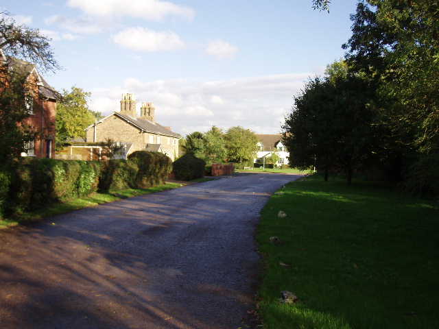
Parked on lane near Bramfield Woods.
Walks 6 and 7 of the Hertfordshire Chain Walk start at the same point, and as they are each only 4.5 miles long it seemed sensible to combine them into one walk. Walk 6 goes in an anti-clockwise loop south from Bramfield Woods, whereas Walk 7 goes in a clockwise loop north from Bramfield Woods to Watton-at-Stone and back. This meant today’s walk formed a figure-of-eight, and doing it in both directions meant I walked a total of 18 miles. Although I knew this meant I would be more tired than usual at the end of the walk, I was still particularly looking forward to doing it as the description in the guide book indicated that it was on good clear paths throughout and in an attractive area of woods and open fields.
The forecast yesterday indicated that today would be dry with sunny intervals – foolishly I forgot to check it again before I set off this morning. Although it was dry when I drove from Kensworth, there were some very ominous dark grey clouds about and I felt pretty certain that I’d be in for at least some rain during the walk.
[1] Tewin Hill
[2] Path through fields near Queen Hoo Hall
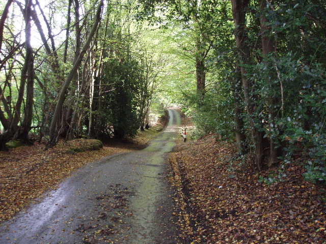
When I reached Bramfield Woods, I had a slight problem parking. The guide book indicated that there was a car park along a track on the eastern edge of part of the wood that adjoined the road going west from Bramfield. In fact there was a metal barrier across the end of the track, with just a few spaces on either side of the road where maybe 4 or 5 cars could park. So I started today’s walk by walking down the track, trying to work out where the car park had been, as that was where the walk was supposed to start. I needed to find it so that I could then follow the instructions in the guide book. There was no real evidence of where the car park had been, nor was there a gate across the track mentioned in the book. I went across two junctions to clarify that I knew where I was on the sketch map in the guide book, then turned round and took a path that was now on my right. This led through the trees in the direction I knew I needed to go, but I’m not sure that it was the correct one – there wasn’t a bend and a left turn as mentioned in the book. Anyway it took me through the trees to a gravel track, where I turned left and soon came back to the road, opposite the start of a lane called Tewin Hill – at least I now knew I was on the right route [1].
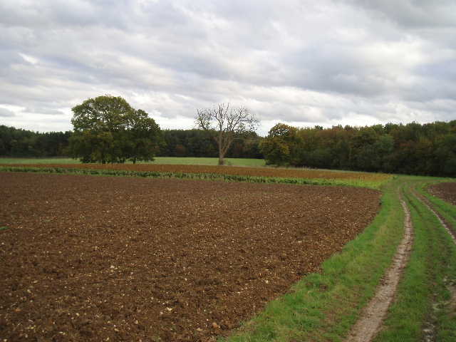
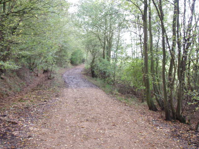
I crossed the road and followed the lane for about a third of a mile, down hill slightly at first then rising again, with woods on either side. Where the lane turned sharply right, I took a bridleway on the left, a broad track to the right of Queen Hoo Hall, an attractive old house that dates back to at least the time of Elizabeth I. This track descended slightly with open fields on either side (i.e. no hedges or fences separating the track from the field). On both sides and ahead of me were more woods, parts of Bramfield Park Wood (as opposed to Bramfield Woods, where I’d started) [2]. The track here was pretty muddy – the guide book had warned that much of today’s walk would be very muddy, but fortunately it turned out not to be anywhere near as bad as I’d feared, and in fact this section was one of the worst of the whole walk. As the track drew near the wood, a small section of the field on my left was planted with maize. Inside the wood, much of the track had been recently resurfaced with gravel so wasn’t too muddy at all. After a hundred yards or so, the path forked slightly left to run along just inside the edge of the wood [3]. After a quarter of a mile or so, the track emerged from the wood at another large open ploughed field, with nice views over the undulating countryside ahead – I could see where I walked near Bacon’s farm on my previous walk.
[3] Path through Bramfield Park Wood
[4] Bramfield church
The track now followed the edge of the wood on the left, with the open field on the right. After a couple of hundred yards, the track turned half-right to leave the wood and cross the field. Again the path was muddy, but not too bad at all. It reached an area of nettles, the site of a farm that was marked on my map but had long since completely disappeared. The track continued onwards between more open ploughed fields. Where it turned to the left, I took a footpath continuing ahead which passed some chicken runs on my right and then passed through the yard of Bacon’s Farm to reach the bridleway I’d walked on the previous walk. I turned left along the hedged track to reach a lane, where I turned left (Walk 5 continued on the track on the other side of the lane). Within a few hundred yards, a footpath sign indicated where I should turn left in front of a house. I followed a gravel track for just over a hundred yards, then turned right along a path following a line of power poles, again with ploughed fields on either side. Where the power line eventually turned half-right, the path continued ahead on a grassy headland for another 150 yards, before turning right along a short section of hedge. Again there were very pleasant views in most directions, the countryside round about being mainly a mixture of open fields and woods.
[5] Bramfield
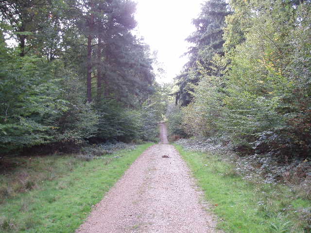
[6] Track through Bramfield Woods
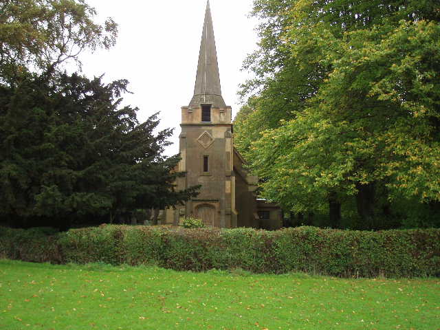
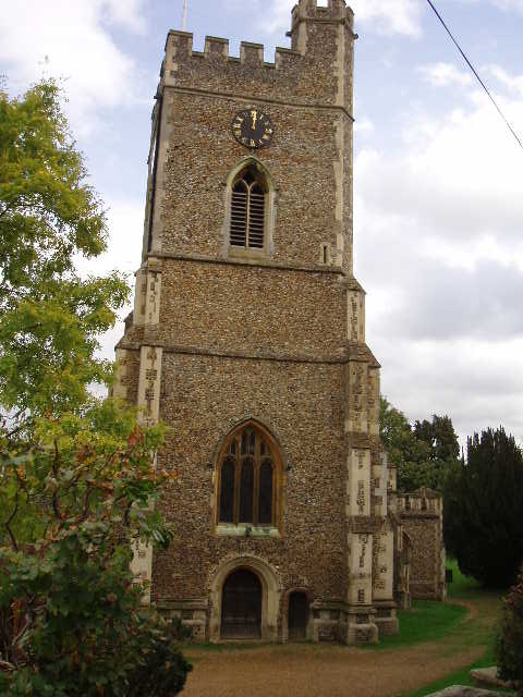
At the end of the hedge, the path went left – it was now on a tractor trail running downhill and then up again through a ploughed field. The path then reached a playing field in Bramfield. I crossed the playing field, following the right hand hedge, soon passing the village church [4] on my right, to reach a road by a pub. I turned right [5] to a junction, where I turned left along the main road through the village. As the road left the village, it turned left. After about a hundred yards I took a footpath on the right, which ran between trees heading slightly uphill. Within a few hundred yards it entered Bramfield Woods and became a gravel track [6]. The woods are obviously a popular attraction, as I met several dog walkers here during today’s walk. They are also a good place for looking for butterflies, as rarities such as Purple Hairstreak and White Admiral have apparently been seen here. I followed the track for several hundred yards, before a left turn took me back to the site of the car park and the end of Walk 6.
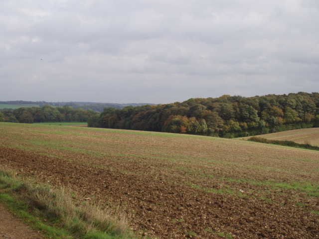
[7]View NW from track to Perrywood Farm
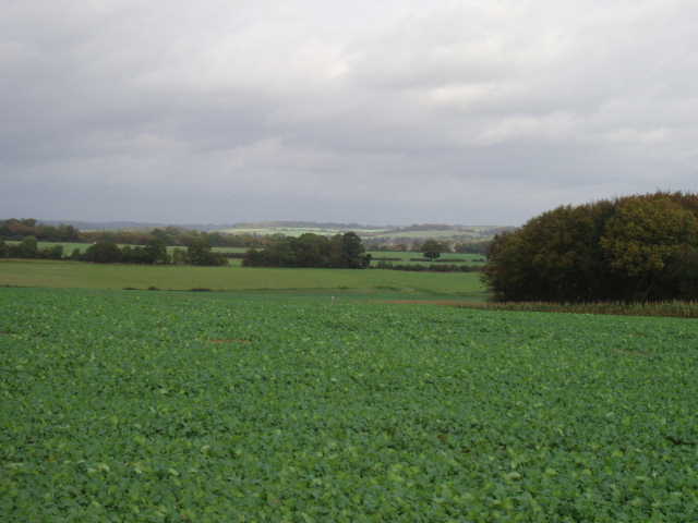
[8] View NE from track to Perrywood Farm
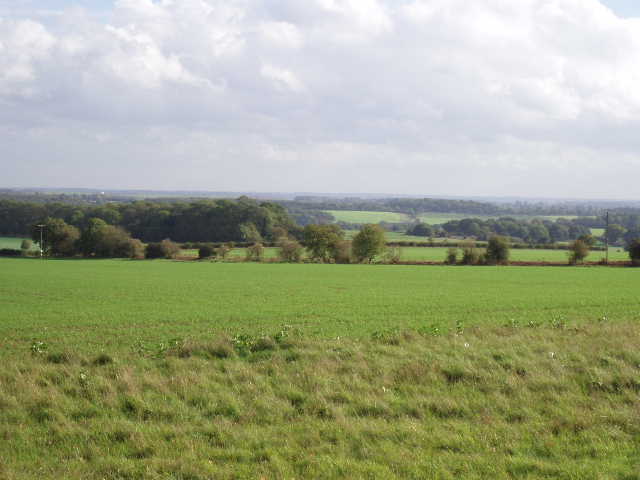
To start Walk 7 of the Hertfordshire Chain Walk I turned round and retraced my steps back to the last junction, where instead of turning right the way I’d just come, I went straight ahead. I was now heading north. The track soon came to a junction, where I forked right on a good track that exited the wood and then ran alongside the wood with an open field on the right, with further woods beyond. The guide book mentioned there was a good view here, and it was correct – a dip formed in the field, which became a valley as I followed the track northwards [7]. There were woods on three sides of the field, and on the fourth side, down the valley, the view opened out to show green fields and more woods in undulating countryside [8]. The sun was now shining and the pleasant view made it a real pleasure to walk down the track. After just over half a mile, the track passed the buildings of Perrywood Farm, and the Hertfordshire Chain Walk then turned left along another track, very muddy in one section, which soon reached another farm where I turned right on a lane.
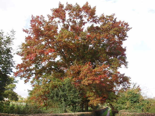
[9] Red Oak (?), Watton-at-Stone
I followed the lane for about half a mile, crossing a bridge over a railway line. I then turned left along a footpath, with the fence of Watton-at-Stone junior school on my right. When the path reached some houses, I turned right along a tarmac footpath, again with the school on my right. I crossed a road and continued onwards into the village, soon passing playing fields and a sports pavilion on my right. I then turned right along a path between hedges, along another side of the playing fields. There were some gorgeous trees here [9], their leaves turning to a wonderful coppery red colour (Update 23/03/07 I now think the trees were Red Oaks). The path led me to Watton-at-Stone church, which I passed on my left to reach a lane [10]. I turned left here, then right at a junction to go uphill. I followed the lane as it left the village behind and went back into open country, re-crossing the railway line on another bridge. After about half a mile, immediately after a lone house, I turned left on a bridleway along a track (if I’d gone straight on, I’d have come back to Perrywood farm again within a few hundred yards). This passed between more ploughed fields, with a small wood or copse on the right at one point to reach another lane.
[10] Watton-at-Stone church
I turned right for a few yards then turned right again along the drive to Great Gobions Farm. I crossed through the farmyard, then turned left to follow a hedge [11] which soon brought me back to Bramfield Woods. On entering the wood, I took a right fork along a green and grassy track – this was the muddiest section of the whole walk. After a few hundred yards this came to a T-junction where I turned left (I was a bit confused here as the guide book said the path turned left, but it clearly came to a path junction). The path was now less muddy, and soon became a gravel track. When this reached a junction, I turned left and continued on this wide gravel track as it turned left, went over a crossroads of gravel tracks and then turned right [12]. When, after about a quarter of a mile, it came to a T-junction, the site of the car park and the end of Walk 7 was just a few yards to my left.
[11] View east from near Great Gobions Farm
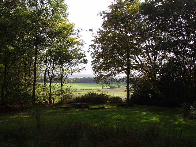
[12] Looking out from corner of Bramfield Woods
It was now 12.55, and it had taken me 2 hours and 50 minutes to walk 9 miles so far. I turned round and started to retrace my steps – I could, of course, have walked Walk 6 backwards before Walk 7, but chose not to. Almost as soon as I started back, while still in Bramfield Woods, I saw a female Muntjac deer come out onto the track in front of me, before it turned and fled back into the trees. Soon after I heard a male Muntjac ‘barking’. As I walked down the lane back to Watton-at-stone it started to rain, but it was not too heavy and I could see it wasn’t going to last long so I didn’t bother putting on my waterproofs. I had lunch on a bench just outside the church in Watton-at-Stone. My father comes from the neighbouring village of Aston, and I had a quick look round the graveyard for any relative’s gravestones, but with no luck – hopefully I’ll have more time on the next walk which also passes through this village. There was no more rain during the rest of the afternoon, although the skies did grow ominous as I got back towards Bacon’s Farm. I was beginning to feel a bit tired by then, as this walk was 2-3 miles longer than most of my walks. I got back to my car about 16:10, having walked for almost 6 hours in all. I was very tired, but not as bad as I feared – apart from the distance, I thought that all the walking through mud would have sapped my legs of energy, but it was nowhere near as bad as the guide book had led me to believe.
This was a really nice walk, in a lovely area of countryside consisting mainly of woods and large open fields. All the paths were very clear, making navigation easy. Apart from the two villages I passed through, Bramfield and Watton-at-Stone, I only went by about four farms and a similar number of houses all day. The paths were a bit muddy, but not too bad at all considering the amount of rain we have had recently – there were only one or two very short stretches where I needed to really concentrate on where I was putting my feet. I think this is a great area for walking, and I may well come back here sometime. On a nice summer’s day when the paths are dry this would make an excellent walk, and it would be very easy to shorten it by a few miles by missing out the section through Watton-at-stone and/or by taking a short-cut to miss out Bacon’s farm. This was definitely the best bit of the Hertfordshire Chain Walk so far.
Total Distance: 43 miles (each way)