Pete's Walks - Hertfordshire Chain Walk
If you are considering walking this route yourself, please see my disclaimer. You may also like to see these notes about the maps and GPX files.
Walk 8 30/10/06 Watton-at-Stone going North (7 miles each way)
Parked in Mill Lane in Watton-at-Stone.
This was a grey overcast day but fortunately it stayed dry until I was driving home, when there was a light rainfall. It was very mild though, as it has been all this month. The temperature was 18-19C, very high for the end of October. I parked in Mill Lane in Watton-at-Stone, as suggested in the Guide Book. Curiously, although Walks 7 and 8 both pass through this village, they do not actually connect with each other, meaning that the Hertfordshire Chain Walk is a long-distance path with a hole in the middle! This seems a rather puzzling and somewhat unsatisfactory state of affairs to me, so before I started out on the route of Walk 8 I took a short walk through the village to a point I’d passed on my previous walk. This was easily achieved – a short distance along the main street from Mill Lane there was a footpath on the right, then a left turn on another tarmac path took me to the sports centre near the church.
The village has an interesting history. A Roman road from St Albans crossed the river Beane here and in 1016 a battle between the Danes and Saxons took place nearby. The name ‘Wattun’ first appeared in an 11th-century publication of 10th century Anglo-Saxon wills. It appears as both ‘Wodtone’ and ‘Watone’ in the Domesday Book. The suffix ‘-at-Stone’ was added during the 13th century because of the presence of two large pieces of Hertfordshire puddingstone (which are now to be found at one of the several pubs in the village). The flint church of St Mary and St Andrew was built in the 15th century, and the village has several buildings dating from the Tudor through to late Georgian periods. Another claim to fame for Watton-at-Stone is that it is the birthplace of Rupert Grint (Ron Weasley in the Harry Potter films).
[1] Footpath along valley, north of A602
[2] Start of bridleway leading to Burn's Green
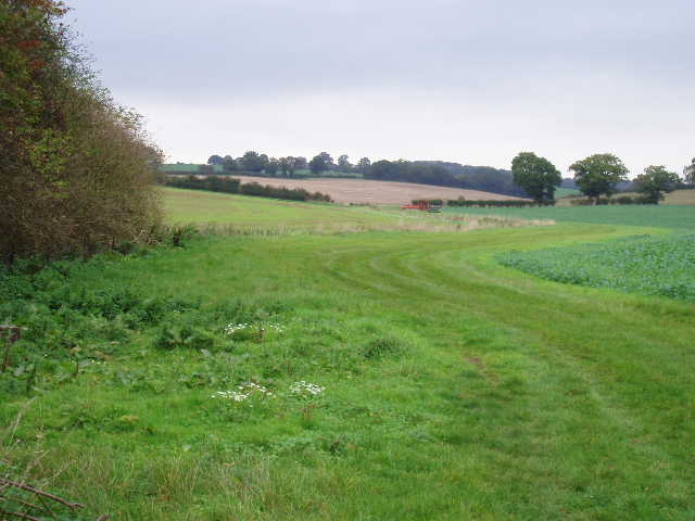
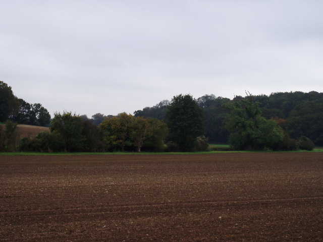
From the end of Mill Lane, I took a footpath going left, roughly north-west. This followed the left-hand hedge of a large grassy field, with trees on the other side of the field screening the busy A602 road. After about quarter of a mile, where the hedge turned left as the field widened out, the path continued ahead across the field, veering slightly right, to pass through the trees and reach the main road. Safely across this, another footpath continued in a northerly direction, at first with a hedge on the left but then following a ditch for several hundred yards [1]. There were large fields of stubble on either side, with the path running along the bottom of a shallow valley. When the ditch eventually came to an end, the path turned slightly to the left to reach a hedge. It crossed through the hedge, then turned right to follow the hedge for about a hundred yards. Where the hedge turned to the right, I continued ahead, turning slightly left – there was no sign of a footpath here as I crossed a recently planted arable field, but as I got closer to a bank on the other side I could see a sign post slightly further to my left. I went slightly wrong here – I should have continued in the same direction across the corner of the next field, but again there was no sign of that path so I followed a clear bridleway that followed the bank to the left to reach a lane, where I turned right and soon reached the point where the invisible path met the lane (I followed the correct route across the corner of the field on my way back).
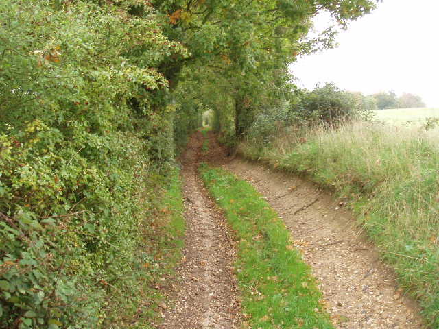
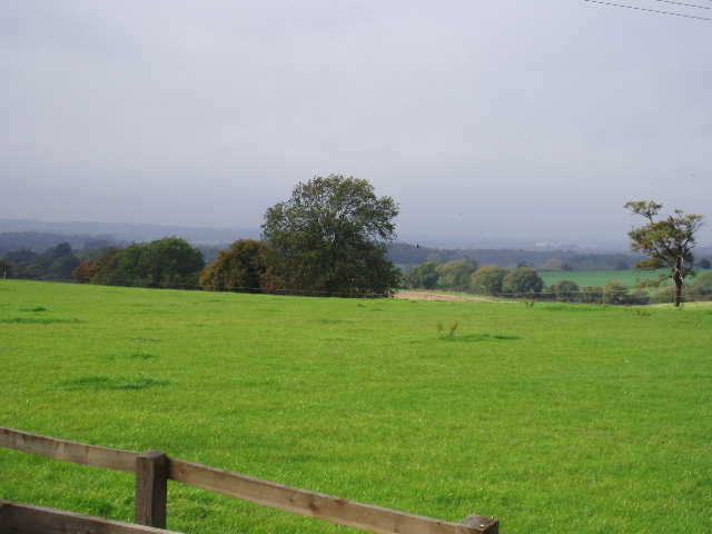
Here I turned off the lane, heading half left along a bridleway that started at the junction of a farm track with the lane. For some reason I really liked this bridleway [2], which ran between hedges with fields either side, going slightly uphill all the time. After a short distance, there was a wood on the right, with several horse chestnut trees as there were plenty of conkers on the ground. I loved the rustling sound of the fallen leaves as I walked along here. I met two horse riders coming the other way, the first of many I would come across today. Beyond the wood, a section of the bridleway was very wet and actually had running water down one side of it, but the other side was not too muddy and did not slow my progress. This was a relatively short section, and soon the bridleway had a good solid surface of stones. Somewhere along here I passed a small pond on my left, the first of at least five that I would see on this walk. After a few minor twists and turns as it ran on between hedges either side, the bridleway came to a lane by a cottage, where I turned right to reach the village of Burn’s Green, soon coming to a crossroads by a pub (The Lordship’s Arms).
[3] Pond at Hebbing End
[4] View from near Hebbing End
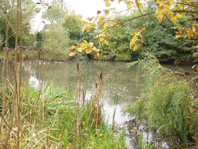
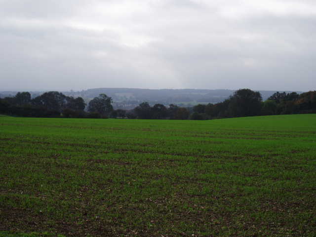
I continued ahead on the other side of the crossroads, passing a pond on my right, through the adjoining hamlet of Hebbing End, still heading roughly north. Near the end of this short road I passed another pond on my right [3], then took a bridleway on the right which led to a field of cabbages or some such. It turned left along the field edge, beside a paddock with a pony and some small show-jumping ‘jumps’ in it, and headed steadily downhill. At the field corner, the bridleway went through the hedge and continued downhill through the next field [4], now with a hedge on the right, to reach a crossroad of paths at the valley bottom. Here I turned right (eastwards) through a gate. I held the gate open for a horse rider approaching from the opposite direction at a gallop. She thanked me, and we got chatting for a while. She told me about the buzzards and deer she’d seen in the area, and how this small valley seemed to have its own microclimate. After she left, I continued on, following a left-hand fence in a grassy meadow to reach a gate. The next field was a large pasture with many sheep, the first livestock I’ve seen for some time on this walk. I followed the left-hand hedge to the far corner, where there was another gate. The guide book said not to go through the gate, but to turn right and follow the hedge line. However there was a fairly new wire fence here, and a good path between it and the hedge, so I guessed that was the path I wanted. I followed it to the right (now heading south, back towards Watton-at-Stone) and it soon crossed through the hedge and became a good stony track. It ran for some time beside a large ditch on the left, which was the Old Bourne, a tributary of the river Beane.
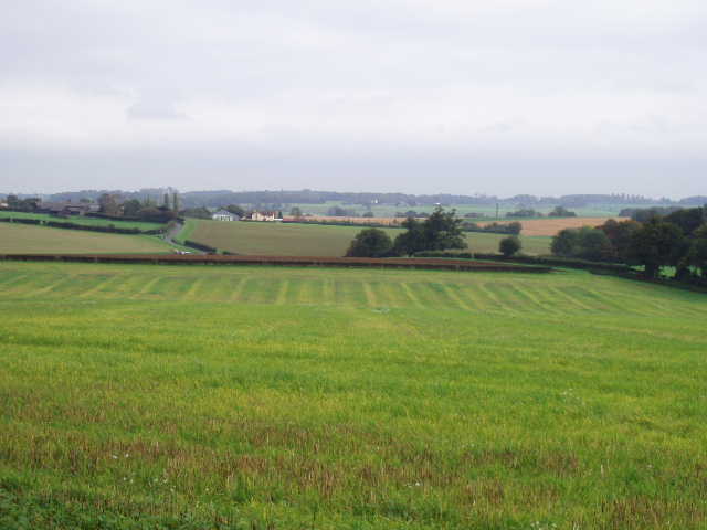
[5] View of fields beyond the Old Bourne

[6] Sunken lane
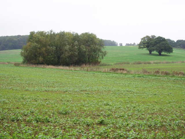
There were nice views on the left over a ploughed field to another hedgerow with trees [5], then more fields and woods above a valley beyond. I could see some more horse riders here, too. On my right there were more sheep pastures – soon the track was running beside a left-hand hedge, with just an electric fence on the right between the track and the sequence of sheep pastures. Then the track started to go uphill through trees – here it was like a sunken lane [6], with steep earth banks on either side. Towards the top, the track had been recently re-engineered and a drainage ditch put in – where the drain went from one side of the path to the other, some low iron rails had been put in, which made a useful seat when I stopped for lunch here on my way back. Near the top of the hill, the track reached a lane. The Hertfordshire Chain Walk continued on another good track on the other side, still through trees, soon passing a very small pond where the track turned to the right. The track ran on between hedges for a few hundred yards. Where it passed a small thatched cottage on the right, shortly before reaching a road, I turned left over a stile and crossed a large grassy field containing a horse and a few ponies. There then followed a sequence of three or four paddocks of untidy and overgrown grass, all but one of which contained one or more ponies. Beyond the paddocks, I emerged into a large open field, where the path continued alongside a wood on the left – there was a clump of bushes surrounding another pond in the field. There were nice views here, looking towards the lower lying land in the Beane valley. In the next field, I continued between the wood on my left and a fence on my right. A gate, rather overgrown with brambles, then took me into a long narrow grass field, still with the wood to my left. At the far end, another gate with a footpath waymark gave access to a lawn which I crossed to reach the drive to the nearby Gregory’s farm.
[7] View southwest from near Gregory's Farm
[8] View south from drive from Gregory's Farm
I turned left along the gravel drive, which soon turned sharply right and then a hundred yards further on turned sharply left – there were more nice views here, over the Beane valley towards Bramfield Woods [7]. I continued on along the well-surfaced track, passing an ordnance survey triangulation column on my left and then some farm buildings on my right [8]. There were some enormous stacks of straw bales here, and I would soon meet two tractors with trailers of more bales that were going to be stored there. After about half a mile, the farm drive reached a lane [9] where I turned right (in the field ahead of me as I reached this junction, I saw a lone Fallow deer on my way back). I followed the lane for another half mile or so, gradually going downhill with nice views ahead of me over Watton-at-Stone towards Bramfield Woods. At the end of the lane, I re-crossed the A602 and took the path continuing ahead of me. This path was tarmac, running between hedges, and was obviously the continuation of Mill Lane before the by-pass round the village was built, as after a few hundred yards it brought me back to where my car was parked.
[9] View from the end of the drive from Gregory' s Farm
I turned round and headed back the way I’d come. I’m sure that it sounds daft to do a circular walk, only to turn round and go back the opposite way, but I do have my reasons. By walking twice as far, it means each long-distance path is twice the challenge. It also means I get to see the scenery in both directions – and walks are different if you do them in different directions. As I rounded a bend near Gregory’s farm, I startled a horse coming the other way – it shied away from me, but its rider calmed it down. Just after I had lunch at the railings I mentioned before, I met four men on motorbikes coming the other way. They seemed to be wearing identical clothing, so I wondered if there was some sort of training school for scramblers nearby. I got back to my car about 2.30pm, the whole walk taking 4.5 hours including a quarter hour break for lunch.
This was another very enjoyable walk, the Hertfordshire Chain Walk so far has been better than I’d expected. Today’s walk was generally on good paths and easy to follow, and passed through very pleasant countryside with some extensive views. Burn’s Green and Hebbing End was the only small habitation passed on the route, apart from the thatched cottage and Gregory’s farm. The walk was noticeable for the number of ponds and horse riders that I saw.
Total Distance: 50 miles (each way)