Pete's Walks - John Bunyan Trail
About the John Bunyan Trail
The John Bunyan Trail is a circular path running from just north of Luton to just northwest of Bedford. It starts and finishes at the Sundon Hills Country Park, and en route it passes through Flitwick, Ampthill, Ridgmont, Cranfield, Bromham, Clapham, Bedford, Elstow, Shefford and Barton-le-Clay, as well as many other villages. It is almost entirely in Bedfordshire, with only about half of a mile of the route near Hexton being in Hertfordshire.
The route visits many sites associated with John Bunyan, the seventeenth century Puritan preacher and writer, author of Pilgrim’s Progress. He lived in Elstow, just south of Bedford, and travelled this area extensively, first through his trade as a tinker and later as a non-conformist preacher. He was arrested and tried at Harlington for preaching illegally and imprisoned at Bedford, which is where he wrote his masterpiece. For more details about John Bunyan, click here to read the entry for him in Wikipedia. There is another informative web site about John Bunyan here.
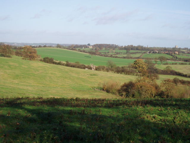
Looking back towards Pulloxhill from the edge of Harlington (Day 1). The Bunyan Oak, under which John Bunyan sometimes preached, is in the centre of the picture. The water tower at Pulloxhill, a prominent landmark on many days of the walk, is visible on the skyline at the far right.
The John Bunyan Trail starts along the northernmost chalk escarpment of the Chiltern Hills near Sharpenhoe Clappers. It crosses a small valley to reach a low ridge between Pulloxhill and Harlington, then passes through Flitwick as it crosses the Flit Valley to reach a ridge of greensandstone at Ampthill. It follows the greensand ridge for a few miles westwards to Ridgmont, then heads north on a low ridge overlooking the Ouse Valley to Cranfield and Bromham. It then follows a large bend of the river Great Ouse through Stevington and Pavenham, before turning south through Clapham, Bedford and Elstow. It recrosses the greensand ridge near Shefford and continues southwards through Shillington to Barton, where it traverses the Barton Hills to reach Lilley. Finally it heads west through Streatley and back to Sundon Hills Country Park. The John Bunyan Trail crosses and/or shares part of its route with the Greensand Ridge Walk, the Chiltern Way and the Icknield Way.
The route of the John Bunyan Trail is marked on the OS Explorer maps 192, 193 and 208. There is no guide book for the path as far as I am aware (although a leaflet is apparently available at a few local museums and tourist offices), but a print-out giving route directions can be downloaded from the “Let’s Go – Bedfordshire’s Promoted Routes & sites” web page. There actually seems to be some confusion over the name of this long-distance path – I always refer to it as The John Bunyan Trail, which is how it is named on the maps and the print-out, but all the waymarks and the two notice boards I passed all called it The Bunyan Trail.
When I did the walk, I was under the impression it was 70 miles long, as that is the distance stated in the two print-outs. However, I have since seen another web site that states the distance as 75 miles, and Google Maps suggests it is 79 miles long! As Google Maps was generally pretty accurate for the Chiltern Way (comparing its measurements to those in the Guide Book), I have gone with their figure of 79 miles.
Click here to see a very rough map of the John Bunyan Trail (but only if you have already read my disclaimer and notes regarding maps).
Note: I have numbered each photograph (in red) and inserted the same number in the text to show where in the walk the photo was taken.
UPDATE 12/10/2019: There is now a web site for the Bunyan Trail, here (this says the Trail is 86 miles long!).