Pete's Walks - John Bunyan Trail
About my walk
I walked the John Bunyan Trail in eleven days, spread over December 2006 and January 2007. As usual, each day I walked a section in both directions, a total distance of 158 miles.
At first I found the print-out I obtained from the “Let’s Go – Bedfordshire’s Promoted Routes & sites” web page to be fairly useless as a route guide. Then I twigged that you were meant to follow the route on the OS maps, and using the waymarks that marked the route, just referring to the print-out at places where there might be some confusion. This I found worked very well. I think there was one place where the route on the ground had changed from that shown on the map, and I came across a very misleading waymark near Lilley (unless a new right of way has been created and the trail rerouted), but generally the John Bunyan Trail was very easy to follow.
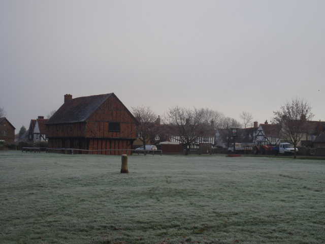
Elstow (day 7) - village green, stump of Maypole and the Moot Hall
The print-out from the web page is pretty much just a route description, with just a few references to sites having connections to the life of John Bunyan. So, as with my previous walk, the Hertfordshire Chain Walk, I spent a little while researching the route on the internet (by simply entering place names into Google and seeing what came up). Most of the factual information I give in this journal is from this source.
Update 17/11/08: I have now replaced the mileages by the values calculated by Google Maps - these differed considerably from my original rough estimates, and added about 9 miles (each way) to the length of the walk! I think the Google Maps mileages are more likely to be accurate - for the 26 days of my second Chiltern Way walk they usually only varied from the Guide Book measurements by 0.2 or 0.3 of a mile (the differences tended to balance out, so that over the whole of that 190+ mile walk they differed by 0.1 mile!).
Click here to see a very rough map of the John Bunyan Trail (but only if you have already read my disclaimer and notes regarding maps).
Note: I have numbered each photograph (in red) and inserted the same number in the text to show where in the walk the photo was taken.