Pete's Walks - STevenage Outer Orbital Path (STOOP)
If you are considering walking this route yourself, please see my disclaimer. You may also like to see these notes about the maps and GPX files.
Day 1 19/08/09 Graveley to Walkern (6.5 miles each way, approximately)
Parked at Gravely.
This was probably one of the hottest days I'd ever walked on since starting this web site. The forecasters had been predicting the temperatures to rise to 28-29C, and indeed the thermometer in my car read 28C as I drove home after the walk. I don't handle the heat well, and despite drinking almost 2 litres of water on the walk I did have a slight headache when I got home - I was just relieved it wasn't one of the mild migraines I get very, very occasionally on such days.
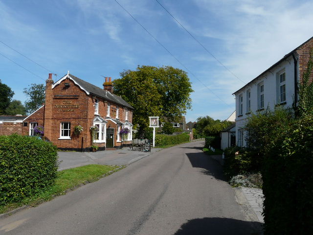
I'd intended to do this walk a couple of days ago, but my car wouldn't start because of a flat battery so I just did a local walk instead. Also, I originally planned to start at Gravely church, but couldn't see anywhere to park there, so parked on the main road [1] and did the quarter mile walk down Church Lane to the church - it just means my fourth and last walk on the STOOP (Stevenage Outer Orbital Path) will be correspondingly shorter.
[1] Gravely
[2] Graveley church seen from Church Lane
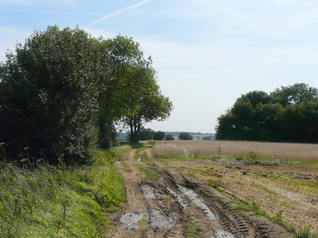
[3] Start of the bridleway to Weston
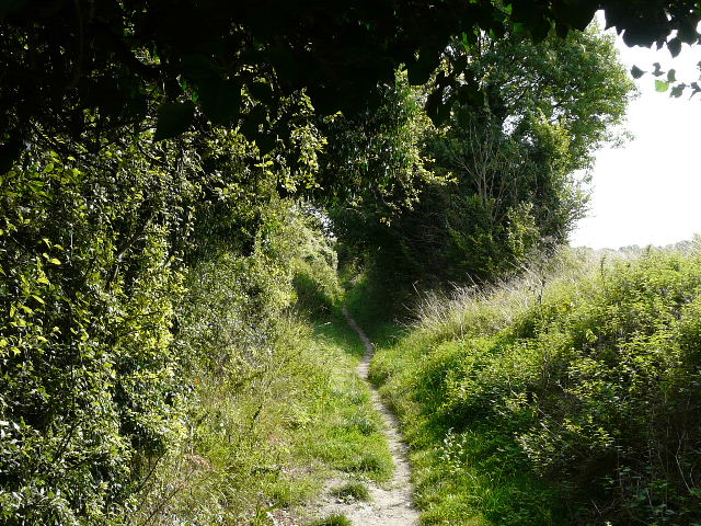
The walk down Church Lane was fine, there was a pavement all the way. There was a pleasant view of the church across a paddock at one point [2]. As I then passed in front of the church (where a poster invited you to attend the village fete and meet Barry Norman) I was briefly on the route of the Hertfordshire Way, which I walked almost four years ago. But that turned left beside the far side of the churchyard, while I continued ahead on a bridleway, which I would follow north-eastwards for almost two miles. Initially it ran gently uphill between hedges [3], with a farmyard on the left. A couple of women with a young girl on a horse soon stopped to let me pass by, the hedge on the left now gone so that there were views across a a valley to the green fairways of a golf course. Looking on the map, I'd thought this would be a long tough uphill start to the walk, but in fact the gradient was very easy indeed [4]. Soon there were views to the valley on my right as well, and I stopped a couple of times to look back over Gravely and towards Stevenage. Far away to my left I could make out Deacon Hill on the other side of Hitchin (it's on the route of my Lilley-Barton walk, amongst others) [5].
[4] The bridleway to Weston
[5] Distant view across Hitchin to Deacon Hill
[6] The bridleway to Weston
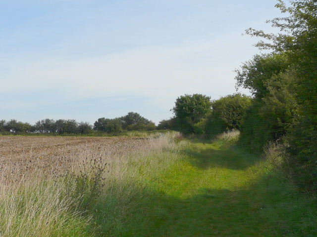
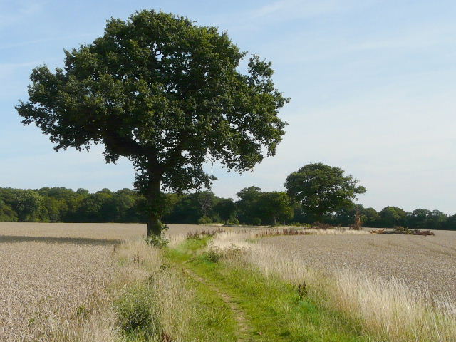
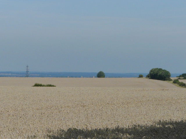
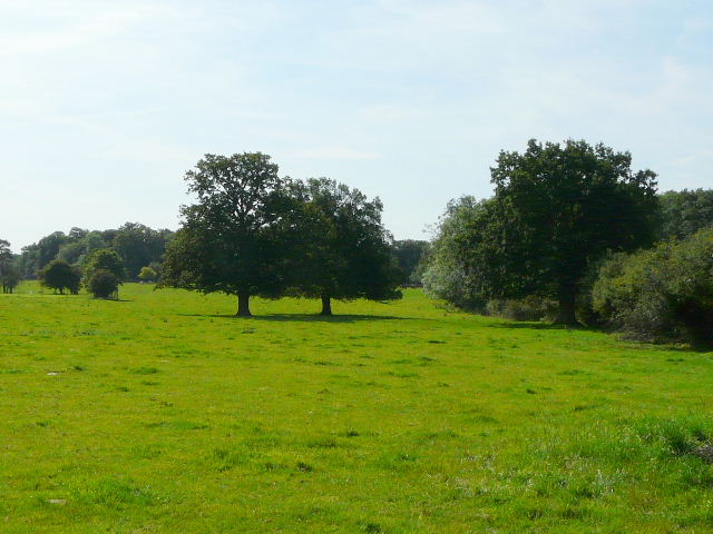
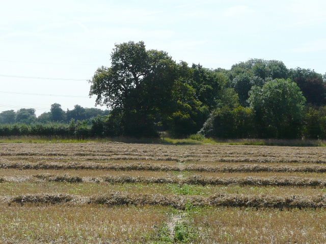
It was already very warm in the bright sunshine, but fortunately there was usually a fairly strong breeze that helped keep the temperature down. Sooner than I'd expected the bridleway flattened out, curving left and then right as it passed through a number of wheat fields. There was now a very pleasant section where the bridleway formed a headland between two large wheat fields, with a few mature oak trees along the way and a wood in view ahead [6]. One of the trees had shattered at a height of 8-10 feet, and lay across the bridleway - I presumed it had been struck by lightning. Further on, the bridleway passed the edge of the wood and ran through a small tree belt. It then continued a little further beside the wood, before a short stretch with more wheat fields either side. Here I could see over the field on my left to where the ground dropped steeply, with a section of the flat lands further north just visible in the distance [7].
The bridleway now turned slightly right by a waymark post, continuing as a farm track through a wheat field. In the next wheat field it deteriorated to two tractor tracks with the crop growing between them, but the tracks were still wide and easy to follow [8]. In the next field, where I followed a hedge on my right, the wheat had already been harvested, the straw lying in large cylindrical bales. Finally I went through a gate and crossed an empty pasture to reach Damask Green, a quaintly named 'suburb' of the village of Weston. I had really enjoyed the long bridleway from Graveley, and just hoped the rest of the STOOP would be as good.
[7] Looking north from the bridleway
[8] The bridleway to Weston
[9] Damask Green, Weston
The route of the STOOP continued ahead along a short residential street, then turned right along a minor road heading southwards out of the village. I soon passed a pub, The Cricketers [9], then went left a few yards down a private drive before taking a footpath on the right. This followed the right-hand hedge of a huge pasture [10] - this, and the subsequent pastures I went through, was clearly part of the parkland around a grand house, as there were mature trees and the odd small copse dotted about amongst the grass. Looking on the map I can see I was close to Weston Park, but I didn't get as much as a glimpse of the property. I remembered crossing a corner of this first pasture on the Hertfordshire Way. I had to brave a large herd of reddish-brown cows and calves in the far corner of the pasture, and as I crossed a farm drive and entered the next pasture, I was back on the route I'd walked four years ago, which I would now follow for about three quarters of a mile or so.
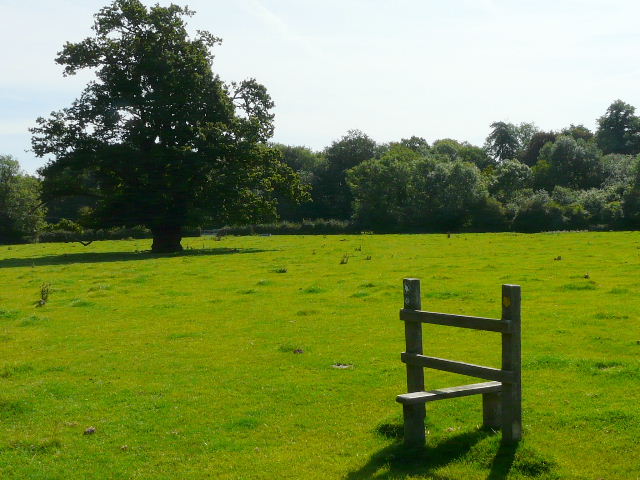
The path followed the edge of a wood on the left, then gradually diverged from it. I went through a kissing-gate into another empty parkland pasture, moving further away from the wood as I crossed it to another gate. In the final pasture, also empty of cattle, I reached a stile standing all on its own [11], which I well remembered from my previous walk here. As always, I couldn't resist foolishly going over the redundant stile rather than round it (and was even daft enough to do the same on the way back!). In fact the stile wasn't entirely redundant, as it served the useful purpose of bearing two waymarks that indicated that the path went slightly left here. The path left this final pasture at a gate by a sharp bend in a lane.
[10] The path through the first pature
[11] The (almost) redundant stile
[12] Path from the lane through Warren's Green
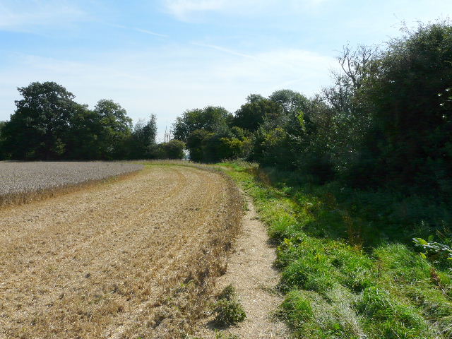
I continued ahead down the lane, passing a single house on either side in the small hamlet of Warren's Green (I've only just now seen the name on the map). The lane soon turned sharp right, and then in a few further yards went sharp left. But at this second bend I walked straight on, following the right edge of another large wheat field [12] - here again the crop had been harvested, with the straw lying in long lines (it was being rolled up into cylindrical bales when I came back later). About quarter of a mile along the hedgerow, soon after a wood on the right ended, I reached a large tree, where I turned left and headed directly across the field (leaving the Hertfordshire Way, and now heading south-east, the direction I'd be following to the outskirts of Walkern). The line of the path was quite clear [13], as I tried to straddle each line of straw I crossed. I was rather surprised to see some Borage growing in the middle of the field.
I next followed a short section of hedge to the right of a large field, the hedge soon being replaced by the narrow end of a small wood. After a hundred yards or so the wood reached a corner, where the field on my left broadened - a clear path continued round the field edge, but a waymark and my map showed that the right of way continued ahead across the field. The field was empty of crops and had been ploughed and harrowed, with just a few weeds and the remnants of last years straw poking through the surface, so it was easy enough to make my way across - I headed for the corner of another small wood on the far side. When I got there, I couldn't see where the path made its way through the thick vegetation bordering the field, so I walked to my right along the field edge to what looked like a gate or stile. When I made my way through the tall grass and wildflowers to reach it, I realised there was no stile and no waymarks. Looking to my left, back the way I'd come I saw another wooden section in the wire fence and made my way to it - sure enough, a stile and waymarks, plus a clear path through the vegetation that I'd somehow just walked straight past!
[13] Path across the recently harvested wheat field
[14] Track just after Dane End farm
[15] View just beyond Dane End farm
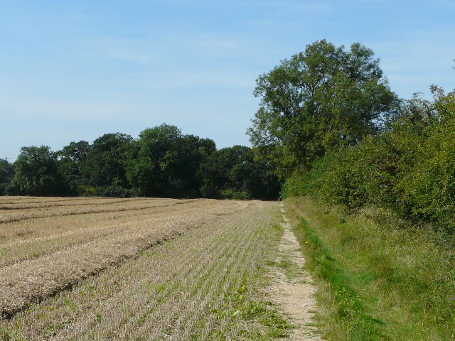
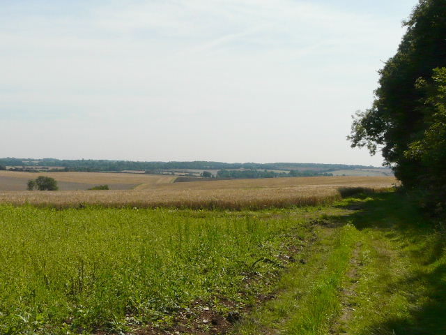
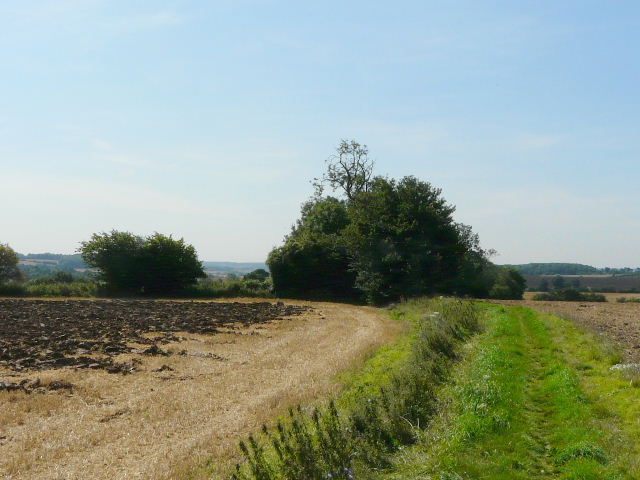
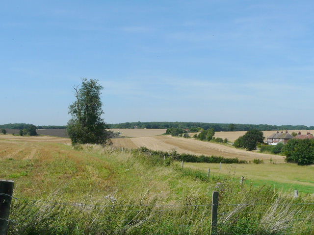
In the subsequent rather overgrown meadow, I had to bear slightly more left than the map indicated, in order to pass a section of the field cordoned off by electric wires, where a solitary horse grazed. The stile on the far side was easy to spot though, and I was soon making my way past the isolated Dane End farm. Beyond the farm, I followed broad hedge-side track to the right of a wheat field - here there was Borage growing all along the edge of the field next to the track [14]. I'm always pleased to see it, I think it's an unusual looking flower and it's one of my favourites. The track passed through a hedge gap in the field corner, with a wood now on my right and another one a short distance to the left. Both soon ended however, as the views ahead opened out over rolling hills of mainly golden wheat fields, separated by green hedgerows with occasional small woods [15].
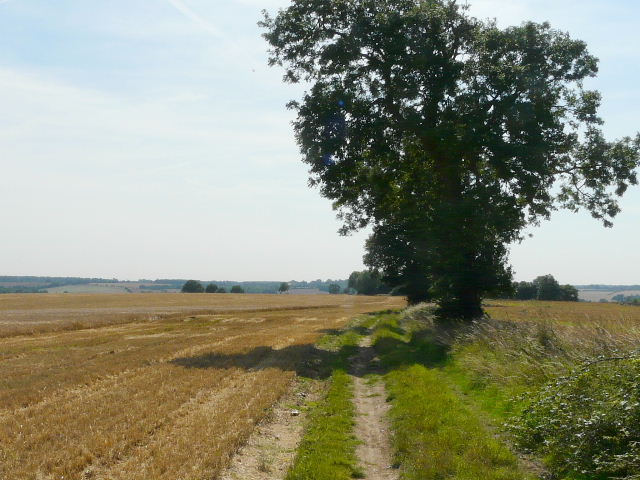
The next three quarters of a mile was very pleasant, as the farm track almost imperceptibly lost height as it followed a very broad ridge between valleys. Like the bridleway I'd been on earlier, this one occasionally passed the odd mature tree [16]. At some point the track became Dovehouse Lane [17], a name very familiar to me as there's one in my home village of Kensworth. There were good views to both sides [18] and ahead of me, as the wide ridge descended down into the Beane valley, where my destination of Walkern was largely hidden from view. In fact I was so enamoured of the scene in front of me, I totally forgot that I needed to turn right at some point. I only stopped and checked the map when I reached a fingerpost pointing left, and realised I should have turned right 200 yards or so earlier. Still, as I made my way back I spotted some lovely Common Toadflax and some Broomrape (possibly Knapweed Broomrape), a parasite I've only come across three or four times. When I got back to the junction, I found the signpost lying flat on the ground. I'd also taken a couple of photos at that point, so that also possibly explains why I'd missed the turning.
[16] The track heading towards Walkern
[17] The track, possibly Dovehouse Lane by this point
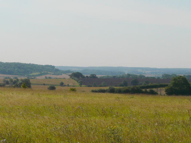
[18] View towards the Beane Valley south of Walkern, where the next section of the STOOP will take me
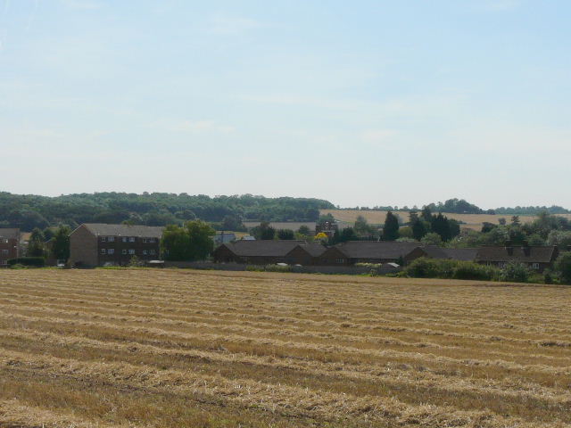
Anyway, the path continued along a headland between two fields [19]. Over a slight rise a hedge started on my left, and in the corner of the field I turned left, joining a track between hedgerows. This soon became a surfaced lane leading into Walkern, with houses on my left and more houses across a small field on my right [20]. I spotted a Comma here, one of very few butterflies I saw today though I did see maybe half a dozen Painted Ladies over the course of the walk. I soon turned right and made my way through the village streets to a minor road heading west to Stevenage. On the other side, the STOOP continues through a kissing gate and across a small paddock, parallel to a drive a few yards to the left. In the next paddock, I went diagonally across to the far-right corner, where there was a nice view northwards [21]. The path turned left here, alongside a huge field of stubble, soon passing a small wind turbine over the hedge on my left. Finally, I turned left again, and followed a path close to the edge of a small meadow or pasture to reach a gate and the road at the very southern edge of Walkern, as far as I wanted to go today. I'd hope there'd be a car park at the Playing Field shown on the map here, that I could use on my next leg of the STOOP - there was a car park, but it was behind the padlocked gates of a sports club, so I'll have to rethink where I park next time.
[19] Path heading away from Dovehouse Lane
[20] Walkern
[21] View north from the edge of Walkern
It was about 12.15pm as I turned and started on my way back - I suppose two and a quarter hours was about right for six and a half miles, considering I'd taken many photos and had had to stop regularly for a drink of water. As I reached Dovehouse Lane and turned back towards Dane End farm, I saw a long line of about 20-25 walkers several hundred yards ahead of me. I never caught them and don't know which way they went, as I soon stopped and sat in the shade to eat my sandwiches (I'd not passed anywhere convenient to sit, so I just plonked myself down on my map case next to the path).
As I passed Dane End farm, I was surprised to see a waymark indicating the STOOP going left down a farm track next to a wood. I knew there'd been a waymark across the harrowed field ahead of me, and I knew I'd followed the route I'd been shown on a map. But curious as to whether the STOOP had been re-routed, I headed off down the track to see. Fortunately, when I came to the next waymark after about a quarter of a mile, I realised it said 'STOOP LINK' - it wasn't the STOOP, it was one of the eight or nine paths that link the STOOP with the centre of Stevenage. Doh! Obviously I had just been really STOOP-id! :) I returned to the farm and continued back on the way I'd come.
Despite the breeze, I started to feel the heat a little in the early afternoon. But that really didn't detract from the pleasure of the walk, and I didn't feel too bad at all as I got back to my car around 2.40pm (although as I mentioned near the start, I had developed a small headache by the time I got home).
I guess any walk would appear close to it's best on such a beautiful late summer's day, but I have to say I was very impressed with this first part of the Stevenage Outer Orbital Path or STOOP. I found the long bridleway from Gravely to Weston (or Damask Green) very pleasant indeed, and so too the bridleway or track from Dane End farm towards Walkern. I will be very pleased indeed if the rest of the STOOP is as good as this section..